This walk starts near to Wales Millennium Centre, at the heart of Cardiff Bay. This area was once a major docks and trading centre, exporting vast quantities of coal from South Wales around the world. The docklands, known locally as ‘Tiger Bay’, was once a grimy industrial area.
In recent decades the area has been transformed, the construction of a barrage and an impressive waterfront development which retains elements of its Victorian heritage alongside smart modern buildings.
Cardiff Bay

We start with a wander around the ‘Roald Dahl Plass’ open space, named after the popular children’s author, born in Cardiff. There’s a mix of the old and the modern, as a restored Victorian terrace, home to the Eli Jenkins Pub, looks across to a modern metallic sculpture.
The ‘Water Tower’ stands at approximately 70 feet high and when working has a constant stream of water flowing down its surface.
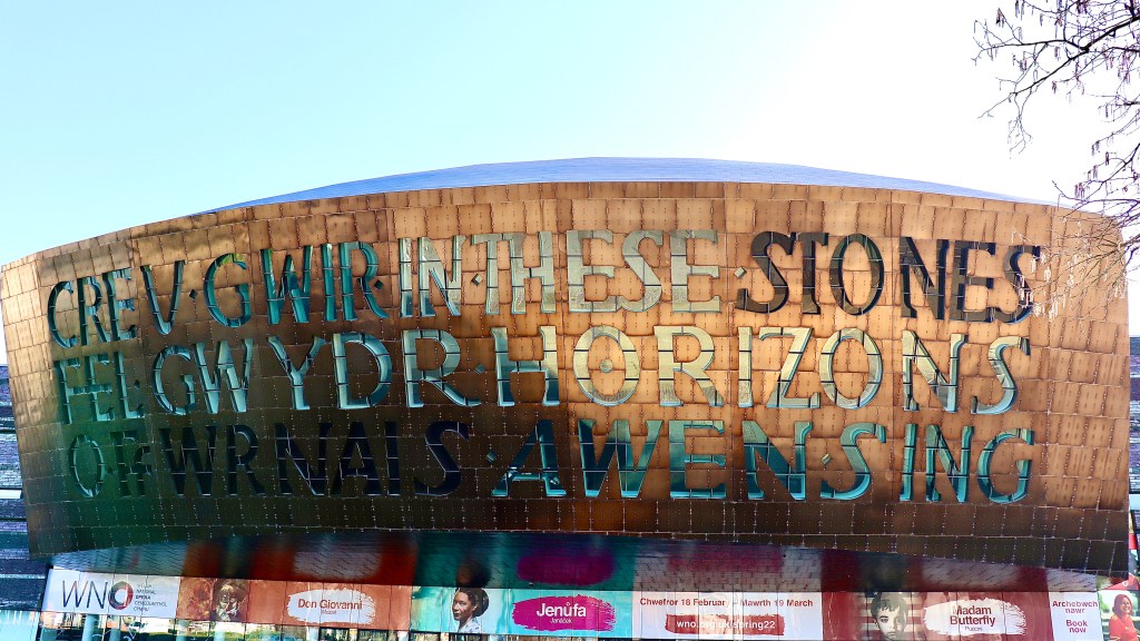
The copper clad dome of the Wales Millennium Centre is an impressive sight with huge lettering etched on the facade ‘In these stones horizons sing’. The outer sides of the building are faced with beautiful Welsh slate, the architect taking inspiration from the cliffs along the Glamorgan Heritage Coast to recreate the impression of layers of rock strata.

A wide plaza leads towards the waterfront, passing a statue of Cardiff born composer, playwright and actor Ivor Novello.
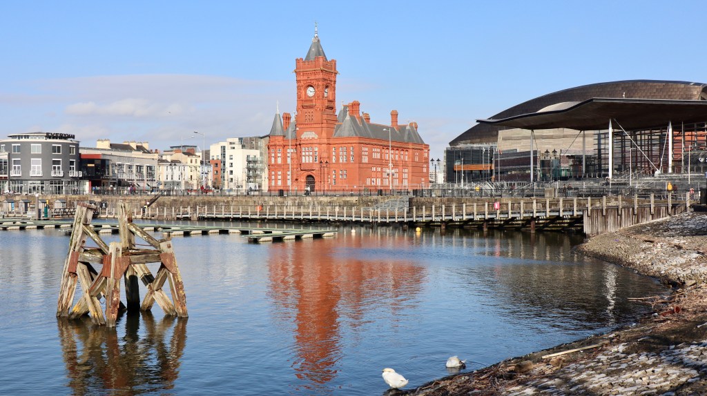
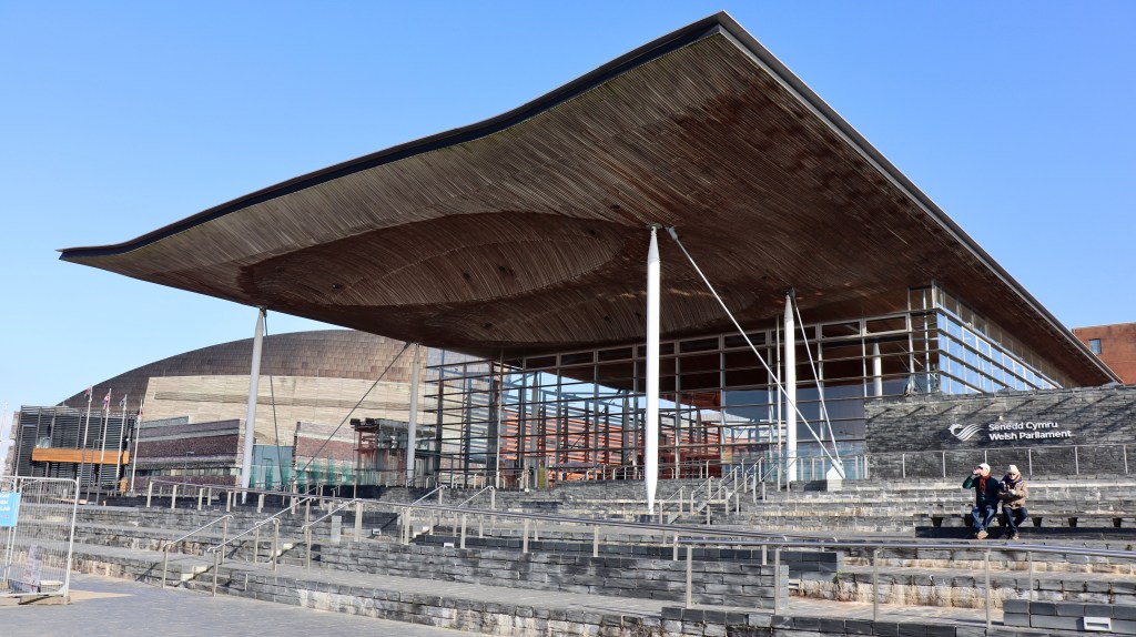
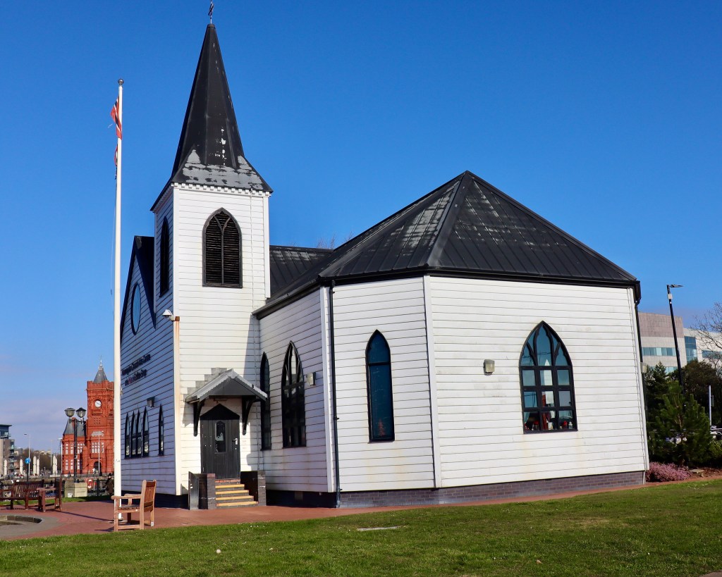
There are 3 landmark buildings along the way. The marvellous gothic style terracotta brick Pierhead building; the modern Senedd, home of the Welsh Government; and the historic Norwegian Church, now an arts centre.
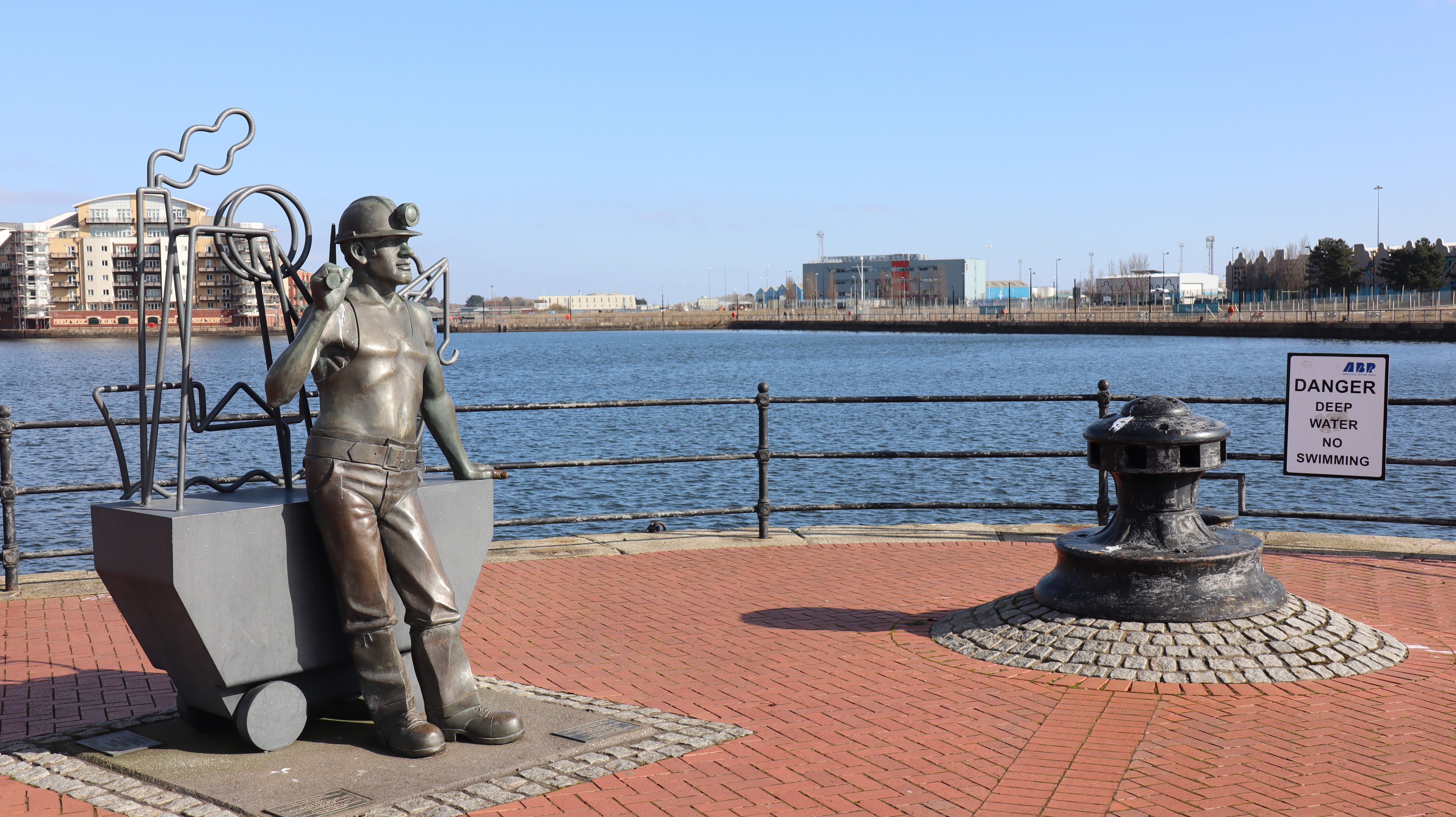
Adding some interest around the bay are numerous public art sculptures. Notable ones are a beautiful and stunning designed memorial to Merchant seafarers lost during World War 2, and another ‘From Pit to Port’ to acknowledge the importance of the Welsh coal industry to the docks.

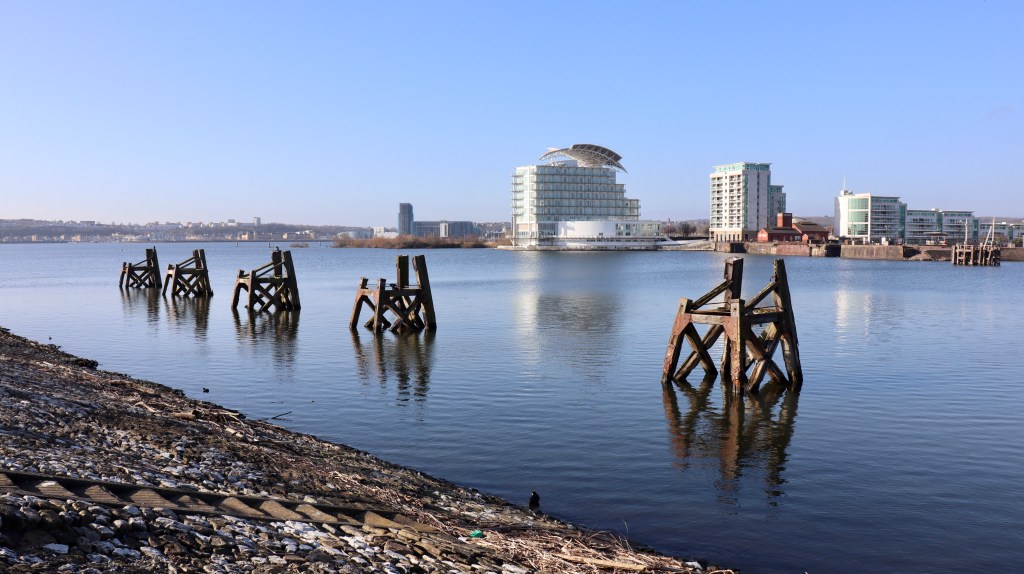
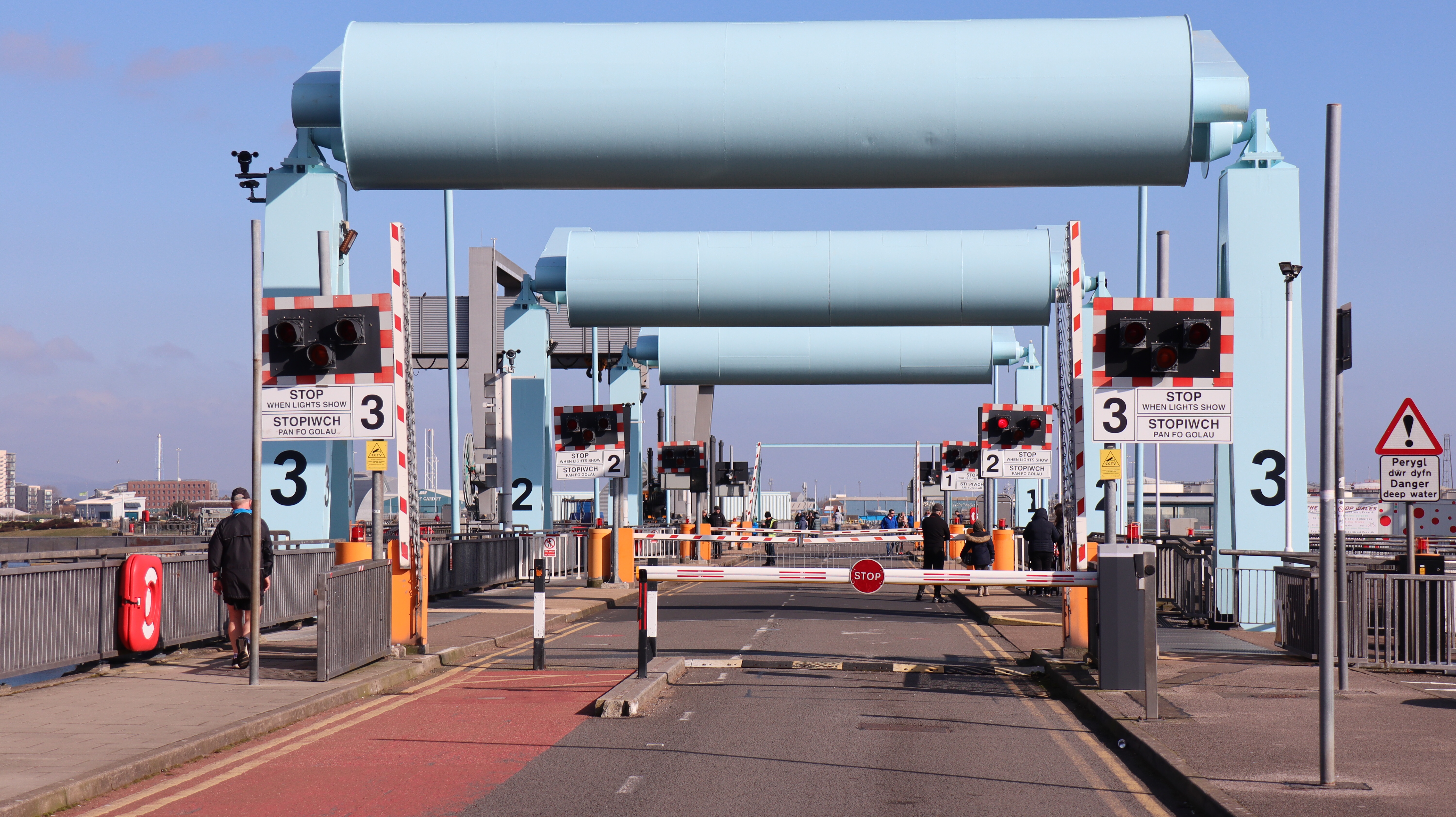
The walk continues around the waterfront, before crossing the Cardiff Bay Barrage.
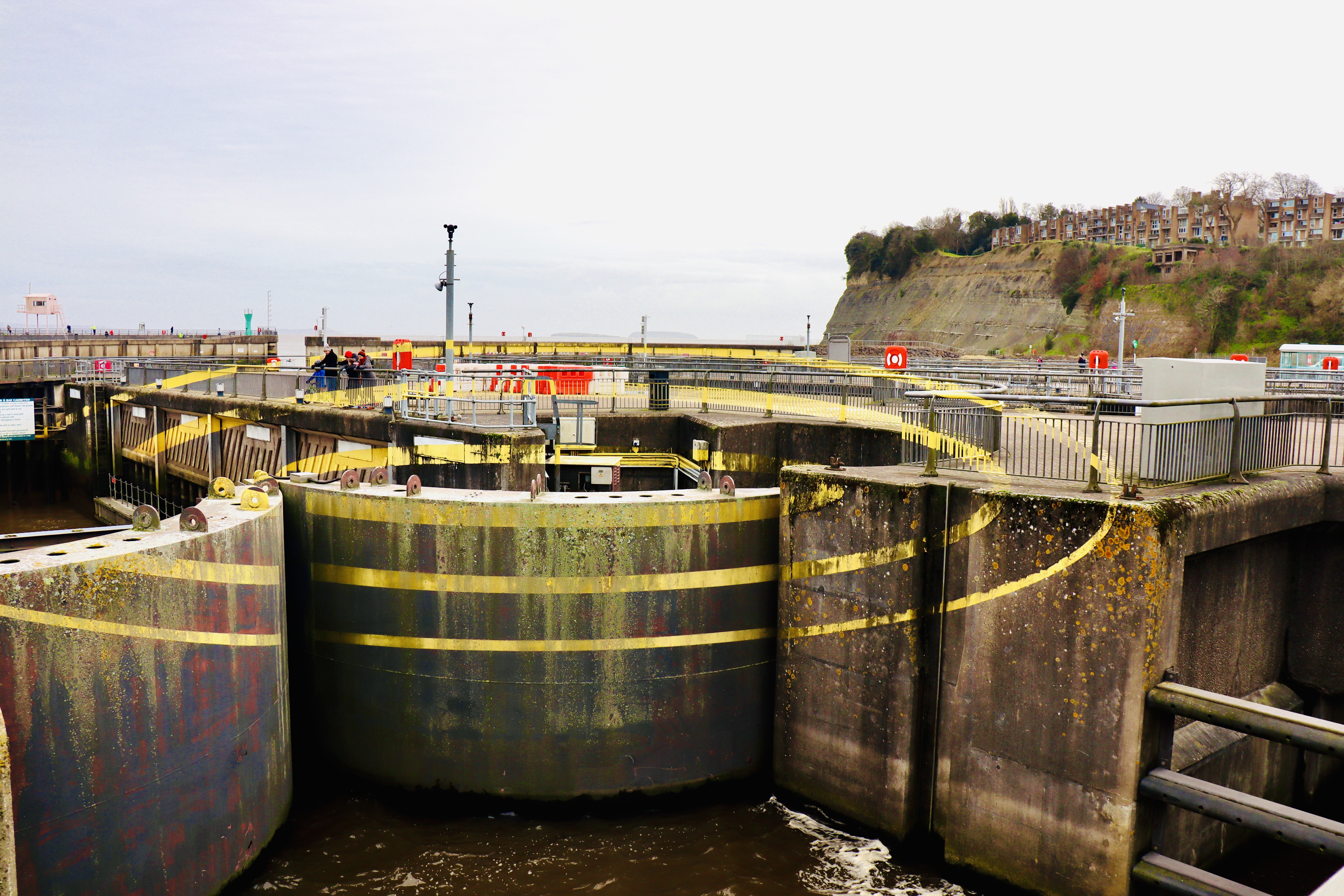
The lock gates, walls and surfaces appear to have random lines of yellow paint, however if you stand in a particular spot at the right time when the lock gates are operating, you’ll see the lines match up to form 3 ovals. This is a public artwork titled ‘3 Ellipses For 3 Locks’. The photo below taken just after the barrage lock gates closed, almost but not quite, captures the fully lined up effect.
Once across the barrage, the route turns right and uphill, passing The Custom House.
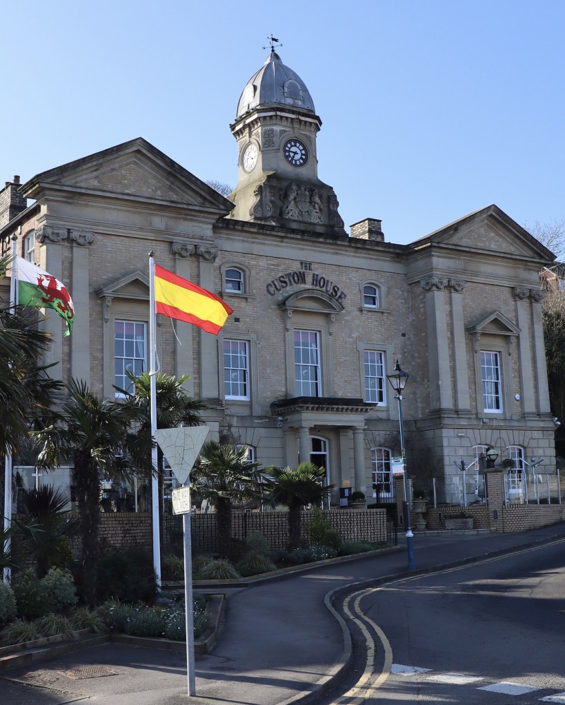
The impressive grand Victorian era building has been restored to its former glory in recent years and is now a highly rated restaurant.
Penarth
At the top of the hill, the path heads along residential streets until reaching a viewpoint at Penarth Head Park. There’s a mosaic of the Wales Coast Path logo and sweeping views over the Bristol Channel and coastline towards Lavernock Point.

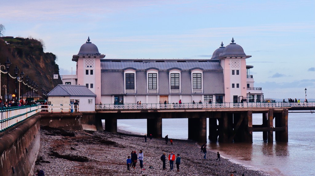
A lane leads downhill and joins The Esplanade, which runs the length of Penarth’s seafront. It’s worthwhile taking the time to view the magnificent restored Penarth Pier, built in 1894.
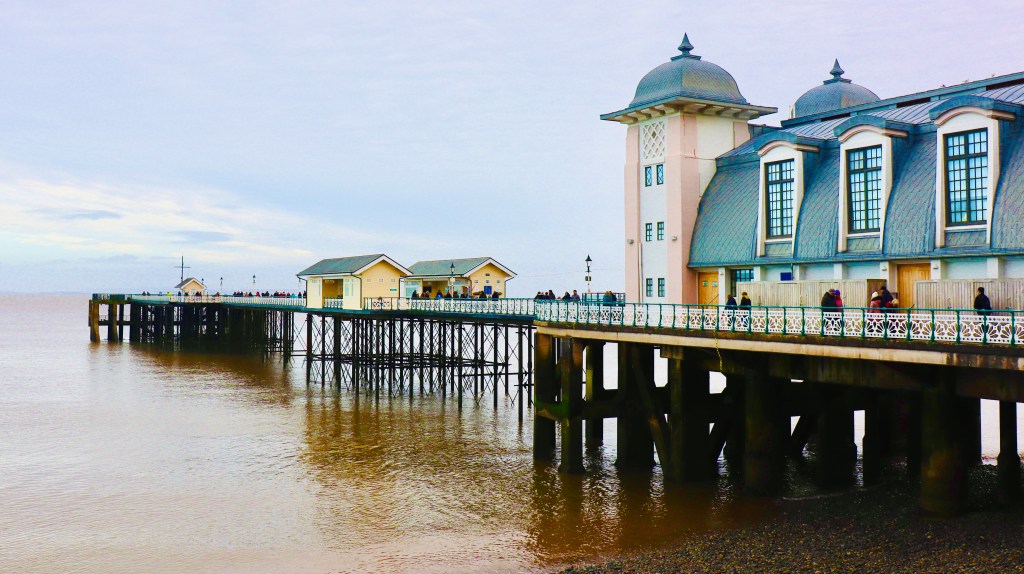
It brought back childhood memories of summer visits many years ago, buying an ice cream at the kiosk and going to the end of the pier to watch local anglers cast fishing lines to the murky waters of the incoming tide.
At the end of The Esplanade the path continues uphill along the roadside then leads through a wide parkland which is a very popular spot, with lots of people walking the area and families enjoying the park. At the end of the open space a rough stony and muddy track continues but is flanked by hedgerows for the most part, so the coastal views are somewhat limited on the way towards Lavernock Point.
Lavernock Point
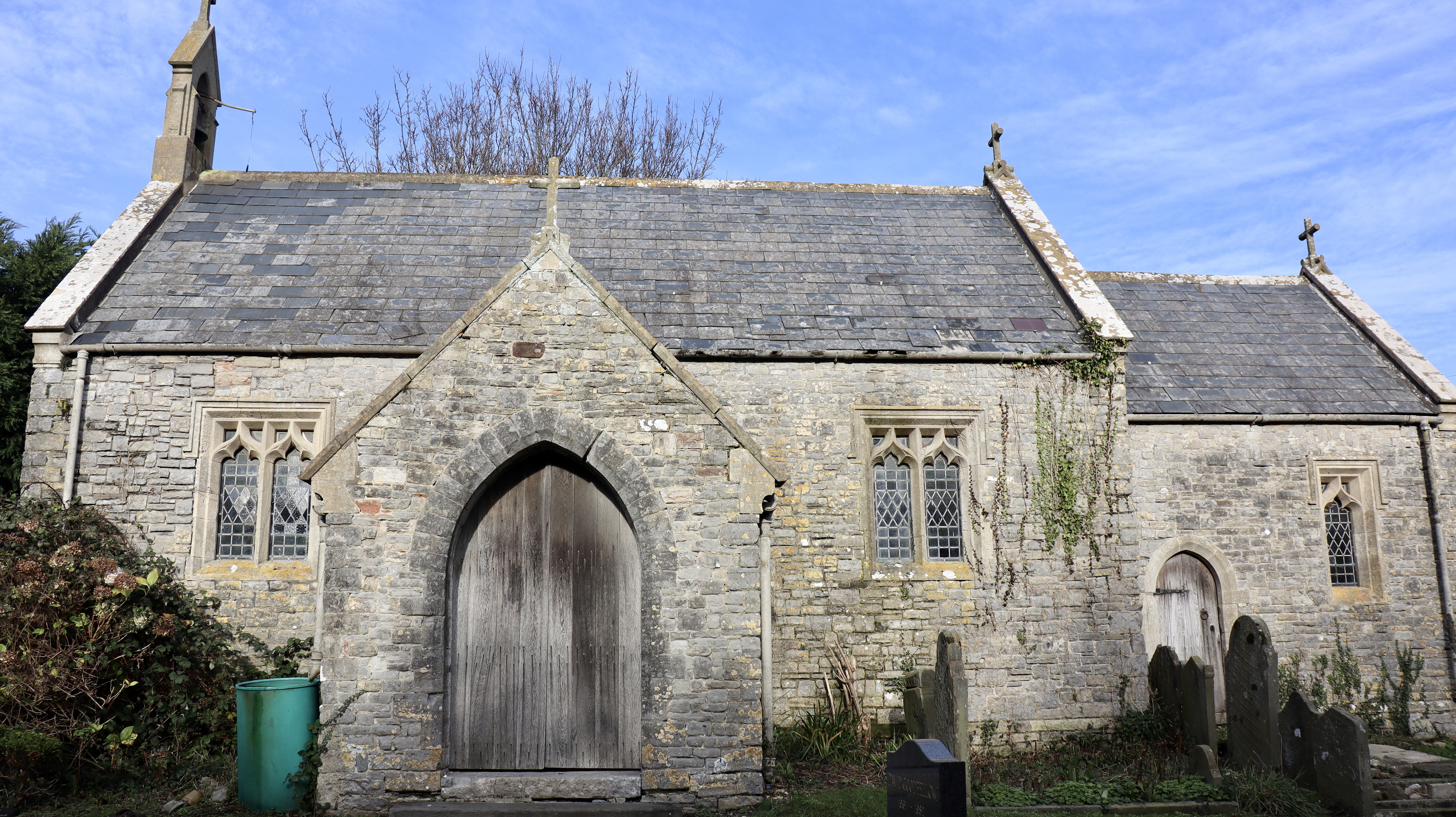
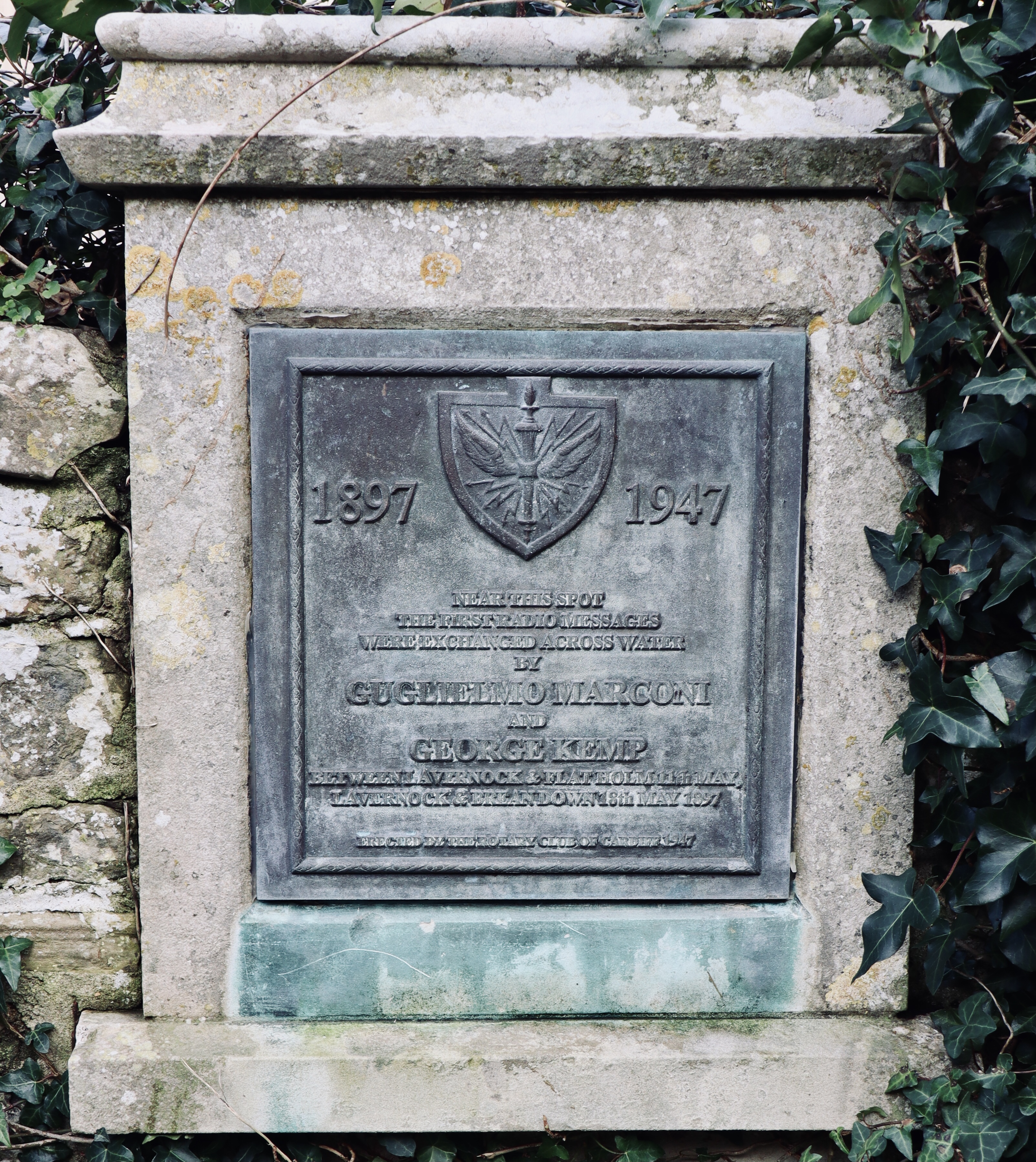
At the end of the track, the route joins a road alongside the pretty St. Lawrence Church at Lavernock Point. There’s an historic event associated with this place. It was here in 1897 that famous radio pioneer and inventor Guglielmo Marconi, set up the first ever transmission of radio messages over sea by morse code. There’s a commemorative plaque on the church wall.
The path goes through Lavernock Nature Reserve, an area of rich wildflower meadows and woodlands seen at their best during spring and summer. The path through the reserve and onwards were very boggy in parts as bad storms earlier that week had left the ground waterlogged.
Lavernock Fort Gun Battery, was developed as a Palmerston fort in 1860’s to protect the Bristol Channel. Once an important defensive site and it’s layout still of interest to military history buffs, sadly it was a disappointing sight on this visit as the area was very overgrown and an information board was in a very poor condition.
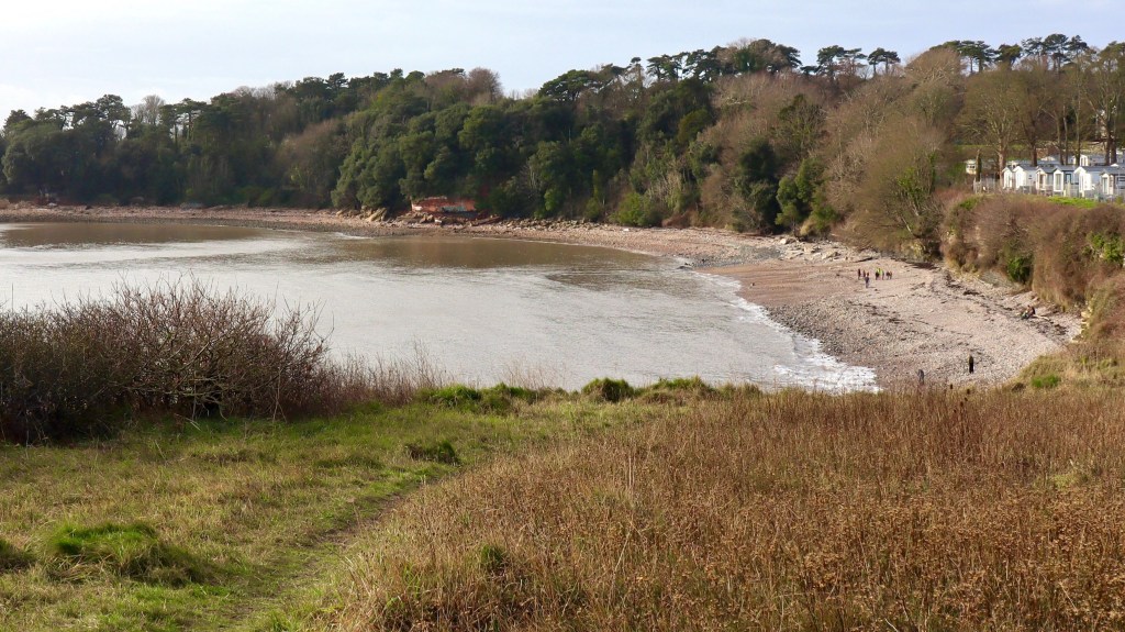
From Lavernock the downhill walk wasn’t easy, due to the slippery conditions on the very muddy path. At the foot of the hill, a grassy open area provides a pleasant viewpoint over the beach at St. Mary’s Well Bay.
The beach is in the ownership of The Bay Caravan Park and with no safe access from either side of the bay, the WCP route heads around the site then across a couple of fields.
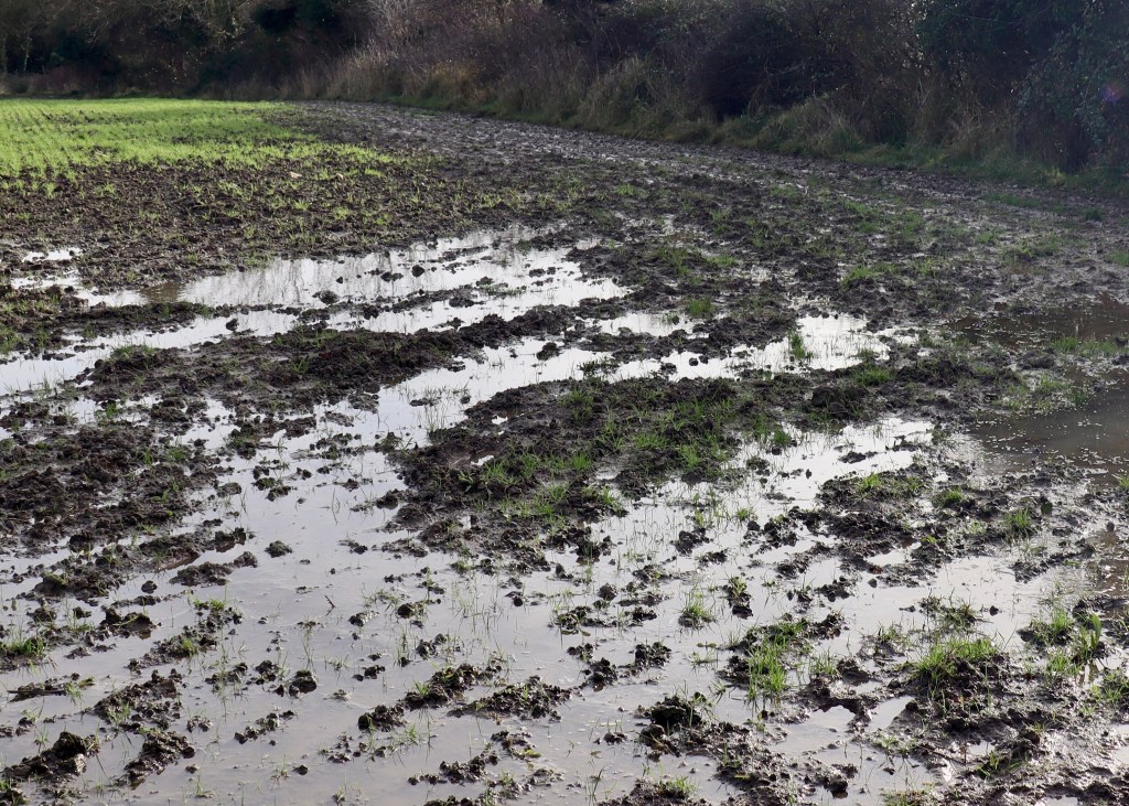
The bay may be named after St. Mary, but perhaps these fields should be named after St. Patrick, as ‘Paddy fields’ would be an apt description during the wet winter months.
So, after walking ankle deep across a couple of swamp like fields, we eventually made our way in mud caked boots to dry land on the road at the other side of the site.
Sully
The road leads downhill to the popular local pub ‘The Captain’s Wife’ at Beach Road, Swanbridge. It’s a nice place for a rest stop with a beer garden overlooking Sully Island.
The incoming tides here are notorious and fast moving with the danger of being cut off for those who walk across to the island at low tide.
Back on our way, the path runs along playing fields at Sully before a rough track leads along the top of a bank at the back of the shingle and rocky beach at Sully Bay.

At the west side of the bay before reaching Hayes Point, the path heads inland then along a road into Sully Village. The Wales Coast Path continues along busy highways and industrial roads to Cadoxton and Barry Docks. As was the case for part of the route on the east side of Cardiff, some sections through busy urban areas hold very little appeal in terms of coast walking.
So we ended this walk at Sully Church, as it’s on the bus route for the no.94 Cardiff Bus service for a convenient return to Cardiff city centre.
Route Stats


Lovely images of Cardiff Bay. It rained for the whole two days I was there – just before the first lockdown, March 2020. I got some, but they are not at all good as I was just so fed up with the non-stop rain, cold hands and feet and wind whipping round every corner. You have shown me how much nicer it could be.
LikeLiked by 1 person
Thanks for your kind comments. What a pity the weather was such a let down on your visit, unfortunately it seems Wales gets more than its fair share of rain!
LikeLike
Gorgeous shot of Penarth Pier, doing full justice to the art deco style. Mine was taken on a rather grey day and looks a little lifeless. I loved Cardiff Bay, especially as it was deserted at dawn. I remember sitting with a coffee and croissant, just taking in the waterfront.
LikeLiked by 1 person
Cheers Tony. Agree with you about Cardiff Bay, it’s very popular but is at its best on a Sunday morning before it gets too crowded!
LikeLike
Probably the most glamorous of all the walks so far.
Brilliant photos of all the iconic landmarks in Cardiff Bay and Penarth Pier.
A very enjoyable description of the journey.
Loved the “returned on the 94 Cardiff bus” at the end.
Somehow totally appropriate to the walk.
LikeLiked by 1 person
Thanks Cato, appreciate the comment. At the time it wasn’t too glamorous wading through the swamp at Sully, so jumping on the bus back to Cardiff was a bonus!
LikeLike
Once again a super narration and wonderful photos of Cardiff Bay.
Liked the pun about the paddy fields at Sully. Looking forward to reading about the next stage of your journey around Wales.
LikeLike
Thanks Petrosa, appreciate your comments, it gives us a spring in the step for our next walks.
LikeLike
Excellent photos! The place is looking beautiful thanks 😊 for sharing 😊👍
LikeLiked by 1 person
Thank you Priti, a lovely comment
LikeLike
It’s my pleasure 😊stay blessed ❤💕
LikeLiked by 1 person