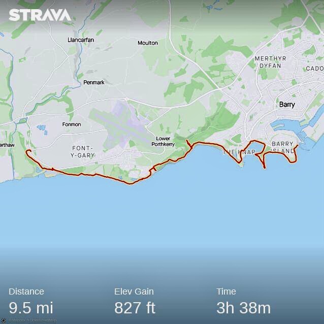
This 9.5 mile walk follows the Wales Coast Path from a start point at Jackson’s Bay, Barry and finishes at the village of East Aberthaw.
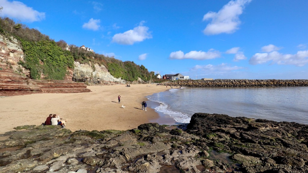
Jackson’s Bay is a gem of a beach, lovely golden sands backed by high cliffs, with a breakwater and Lighthouse on the eastern flank.

The coast path route is along residential streets on the headland above, but we take the opportunity of a more scenic walk across the sandy beach, continuing along a concrete footway around the rocky headland of Nell’s Point
A coastguard station is at Nell’s Point, a good indication of the great views from here across the Bristol Channel. Further along is Whitmore Bay, better known as Barry Island beach, or ‘Barry-bados’ as it’s called by some in South Wales.
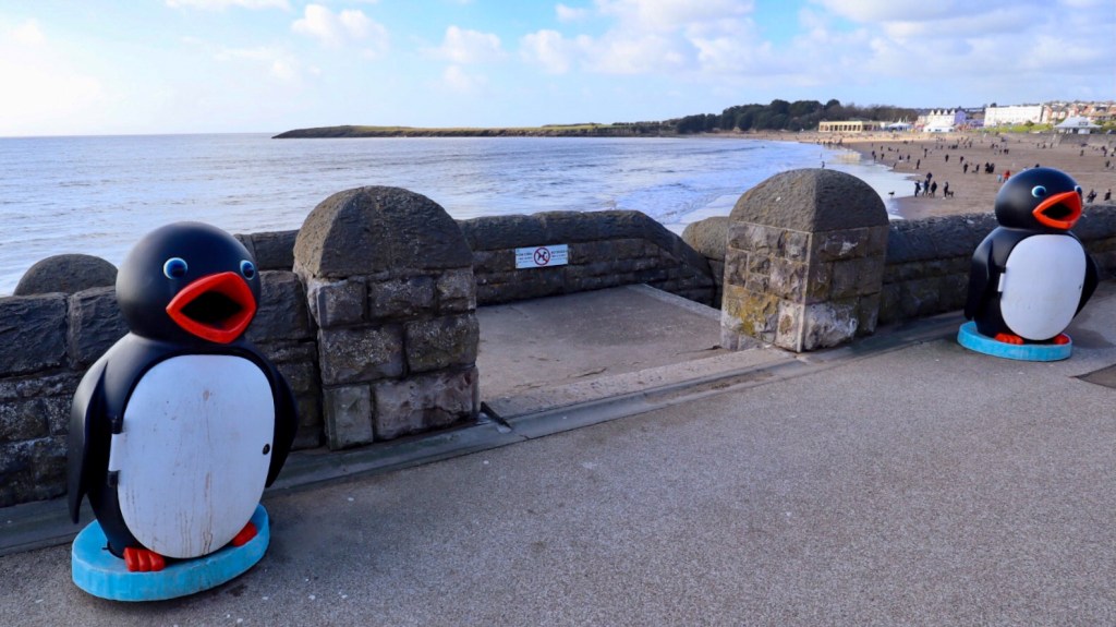
The wide seafront promenade is bookended by a pair of rather grand beach shelters, painted a bright shade of yellow. Walking along the wide promenade above the beach, there’s the quintessential seaside sights and scenes of ice cream parlours, amusements arcades, cafes and an old funfair across the road. My memory of visits here in the 70s and 80s, is of a place that was past its heyday and appearing a bit worse for wear. But in recent years it has enjoyed something of a revival, some nice landscaping and new housing replacing the old holiday camp have improved the place.

The TV comedy ‘Gavin and Stacey’ has also given the place a huge boost and brought a new generation of fans and visitors wanting to experience “what’s occurring” at Barry Island.
After the bustle and delights found along the Promenade, the path heads up a quiet lane towards the headland of Friars Point.
The Wales Coast Path route leads directly ahead, passing the grassy headland of Friars Point, but it’s worthwhile walking out to the point which offers some lovely views across the coastline.

From Friars Point the path leads around the old harbour and a car park, near to the main road into Barry Island. A quirky sign above the road nearby has the Welsh name ‘Ynys Barri’ to welcome visitors.
Further along is a pebbly beach at Watch House Bay, named after an original coastguard watch tower built in the 1860’s, which overlooks the entrance to the old harbour across the water.

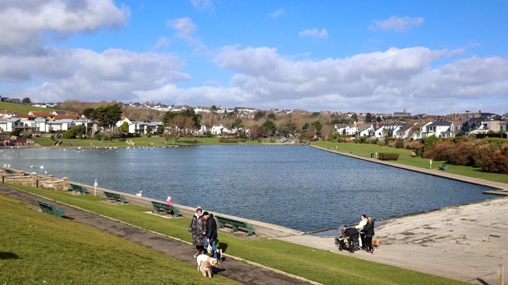
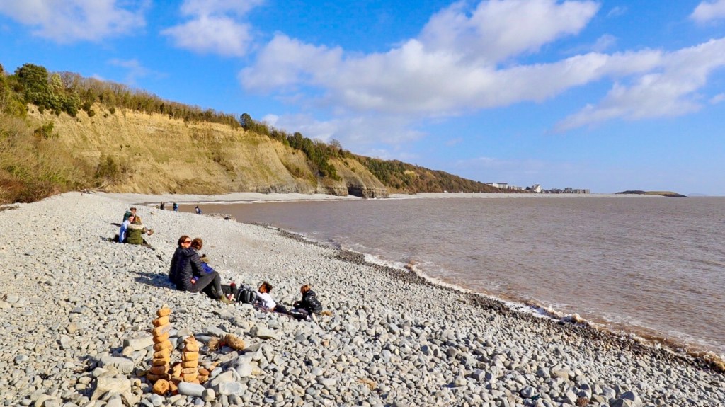
After turning past Cold Knap Point there’s a wide promenade at ‘The Knap‘ above a long stretch of pebbled beach. On the landward side is a nice park with a centrepiece lake in the shape of a Welsh Harp.
At the end of The Knap the path heads uphill, passing by the excavated remains of a Roman Villa, then continues to climb to fields above the cliffs. A muddy track through woodland leads to a flight of steps, known as the ‘Golden Stairs’ as local legend is that gold is buried beneath them.
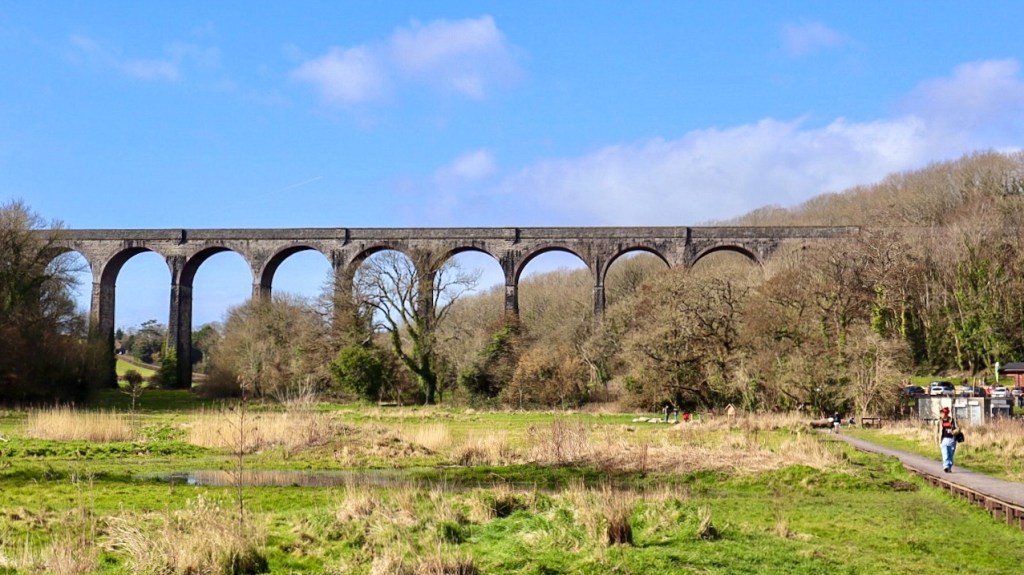
At the foot of the steps is Porthkerry Country Park, and it’s worthwhile walking a short distance onto the pebbled bank at the shoreline. There are superb views along the cliffs and coastline, which you don’t see when walking above.
Behind the beach boardwalks run across the boggy grassland area. There’s a superb view of the magnificent Victorian era railway viaduct which spans the valley. Nearby is Marco’s ‘Cafe in the park’ a good option for a coffee break on this walk.
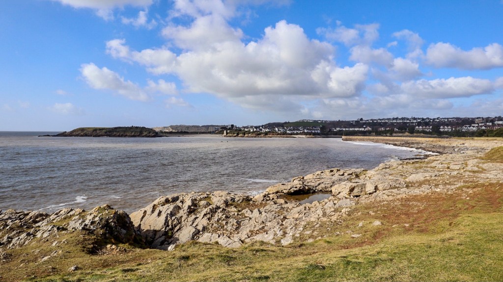
From Porthkerry the path climbs uphill through woodland, a tricky section due to very muddy conditions in early spring. As we walked through the woods a passenger plane flew low overhead, a reminder that Cardiff airport, once known as Rhoose airport, is only a short distance away. Continuing along the route, we went through a caravan park and around a disused quarry then back above the coastline, we reached Rhoose Point, or ‘Trwyn Y Rhws’ in Welsh.
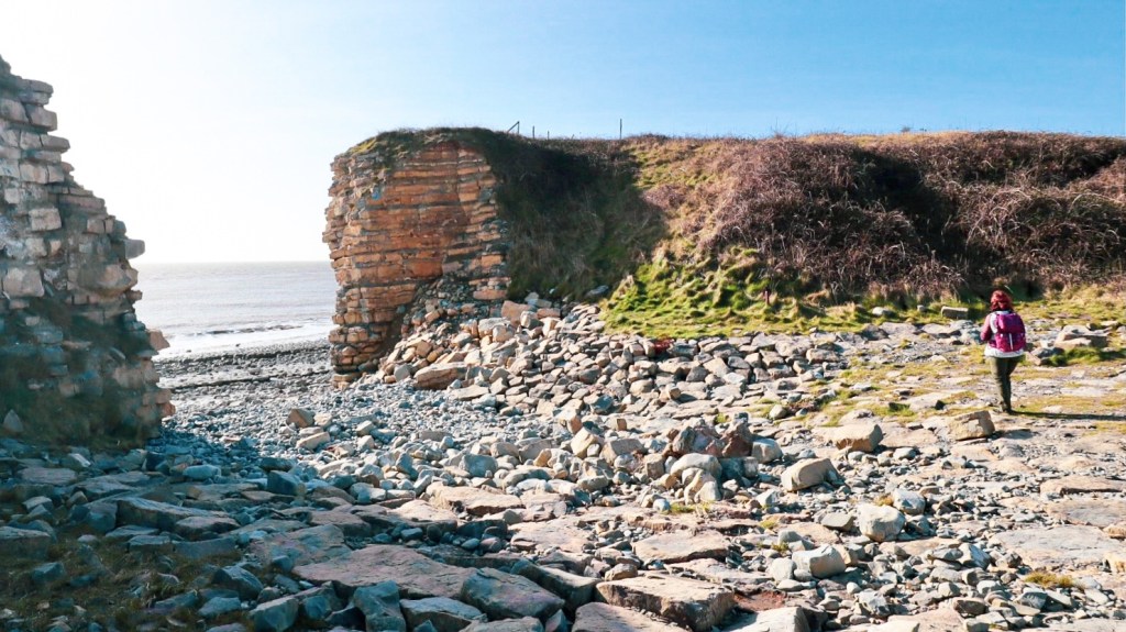
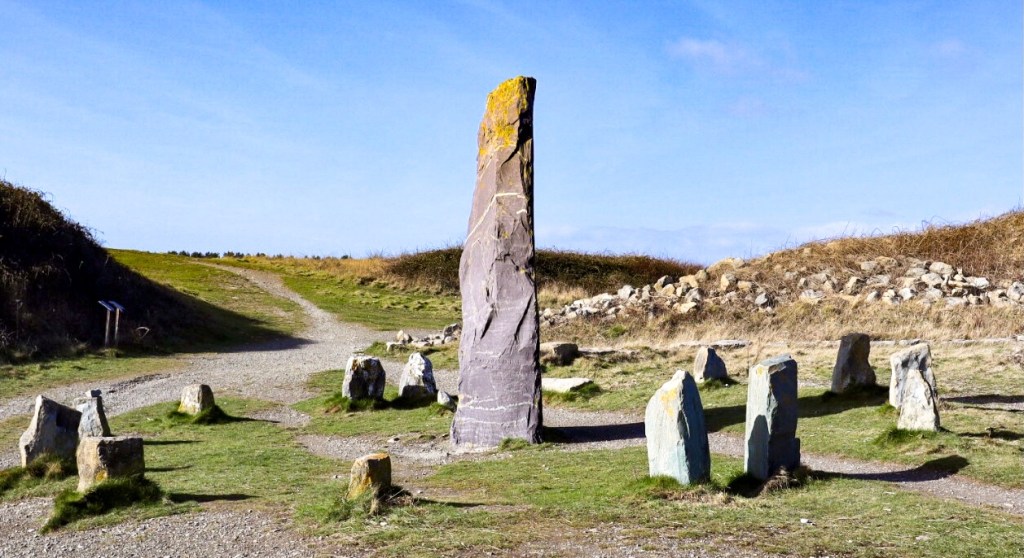
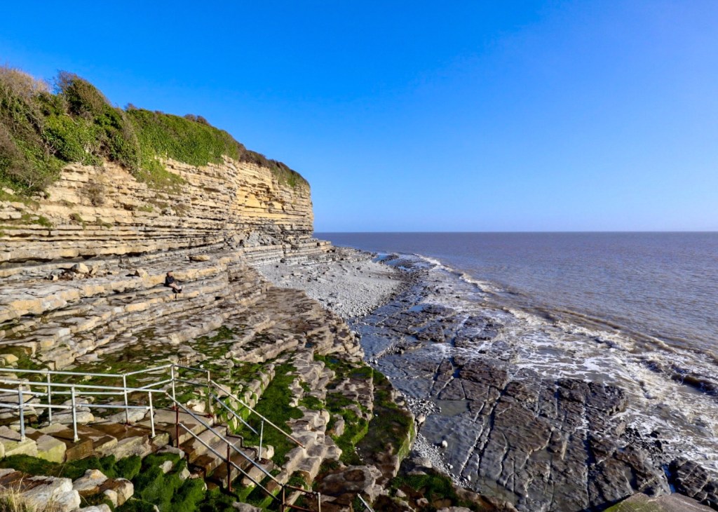
A sign next to the path identifies this as the most southerly point of mainland Wales and nearby are some striking low cliffs forming an entrance to a pebbled beach. The richly coloured blocks of limestone were heavily quarried here in past times. Nearby are a 4 metre tall obelisk, engraved with ‘Rhoose Point 2000 A.D.’ and a stone circle, a modern interpretation of the ancient which adds to the landscape scenery.
The path continues along a grassy clifftop track with super views along the coastline. On the landward side are the remnants of old quarries, now reclaimed as conservation areas with lagoons and wildlife habitats.
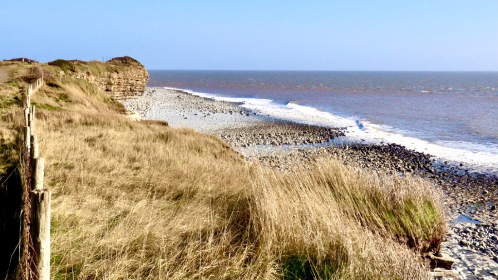
Reaching Fontygary Bay, it’s definitely worthwhile going down the concrete steps to take in the super views of the dramatic cliffs and rock shelves, with waves rolling in at the shoreline. It’s many years since my last visit here and the scenery looked more spectacular than I remembered.
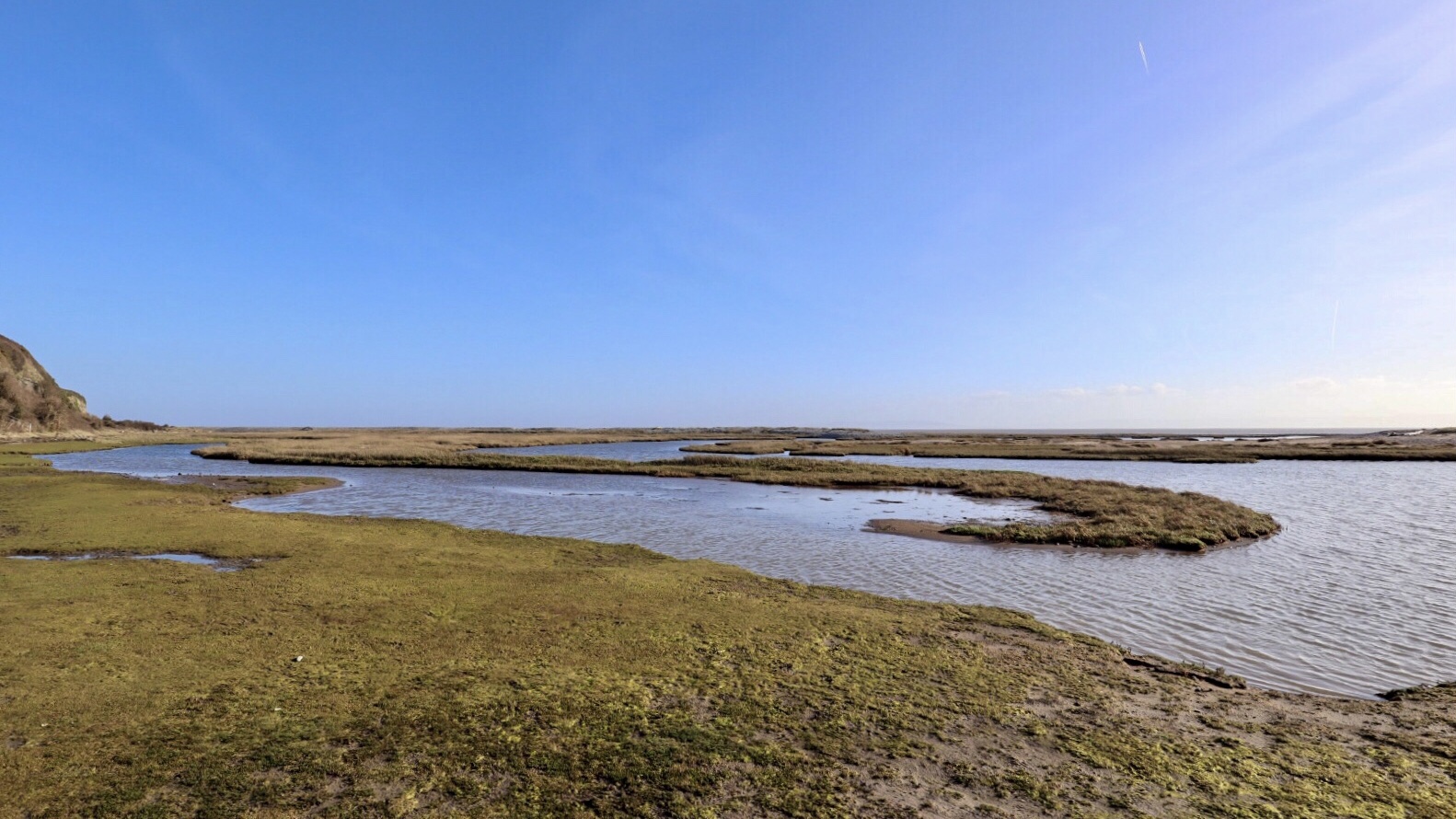
The route continues through the caravan park and then down a long set of steps to reach a path along the salt-marshes at the shoreline.
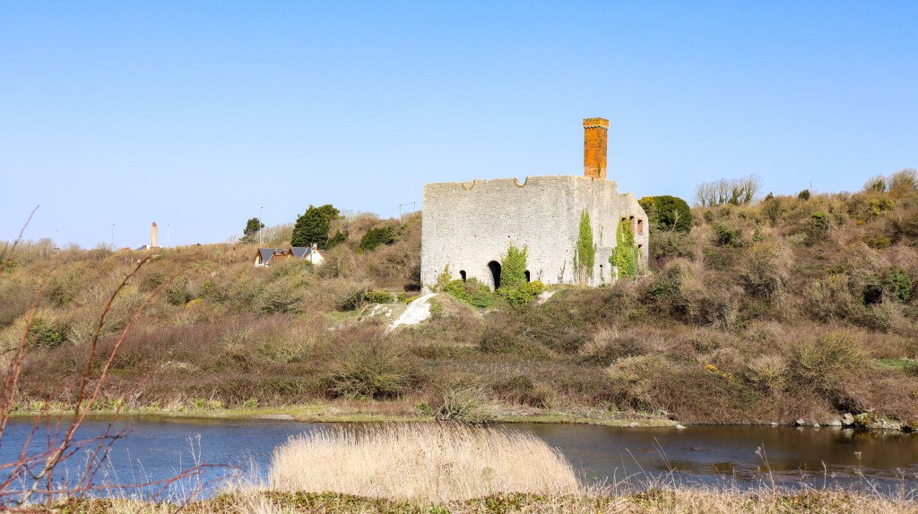
We had reached East Aberthaw, so we leave the WCP and head inland to visit one of Wales oldest pubs. A muddy woodland trail leads up into the village, on the way passing by the substantial remains of an old lime works. ‘Aberthaw lime’ was once produced here, and high quality cement is still produced nearby.
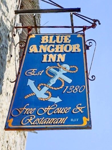
Reaching the village, we made our way to the local pub, the historic Blue Anchor Inn.
I really do like this pub, it’s like stepping back into a bygone time. The stone built, thatched roof inn is reputed to be one of the oldest pubs in Wales., serving ales since 1380.

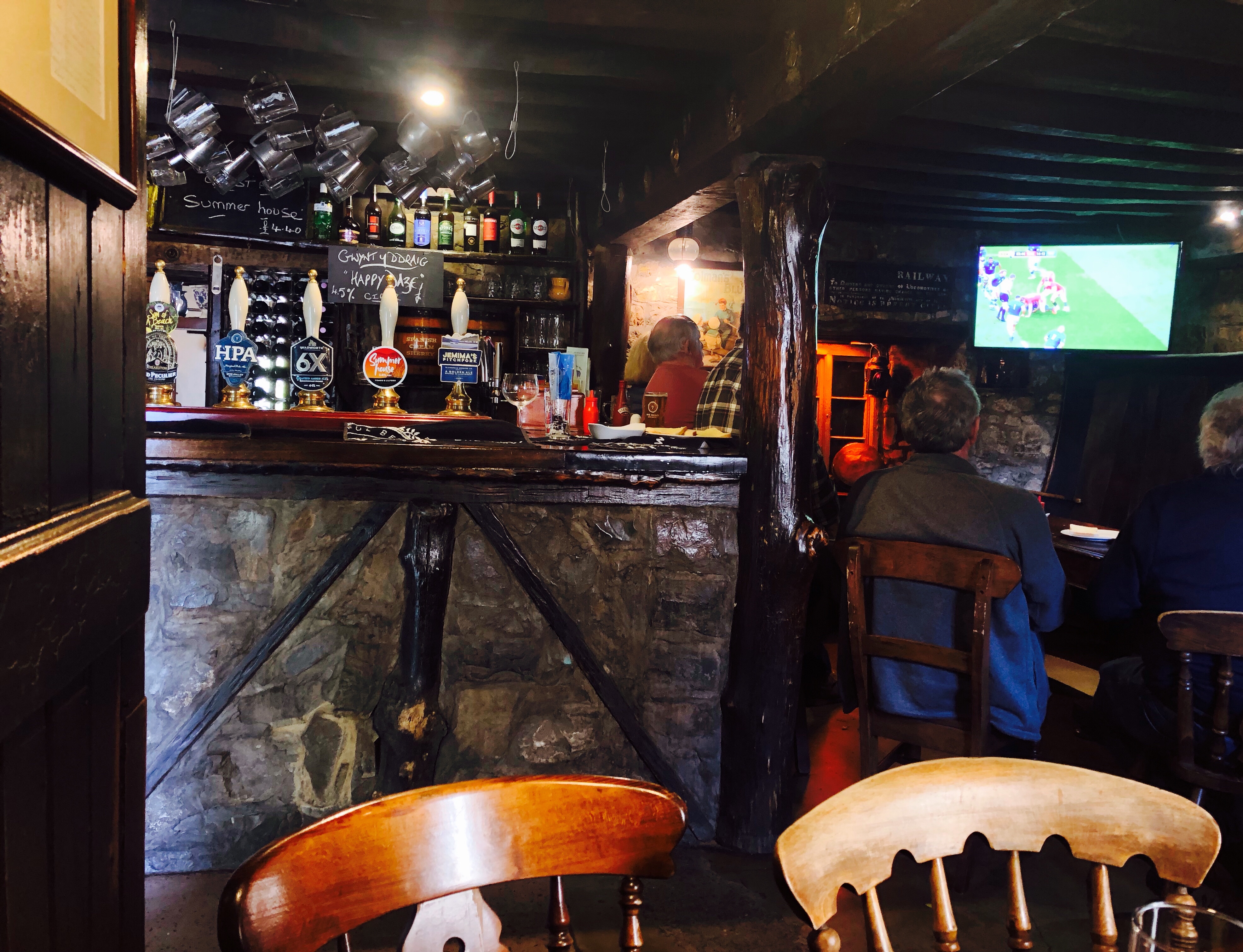
We finished this walk at The Blue Anchor, settling in with a welcome pint and a seat in the cosy, low beamed bar.
Until we lace up our walking boots again, cheers.
Route Stats

Very sensible to skip the road section from Sully to Barry. I loved the variety of landscapes from lovely Porthkerry Country Park (which I walked through pre-dawn from the motel on the A4226) to the power station at Aberthaw. Sadly, I missed that lovely pub.
LikeLiked by 1 person
Thanks Tony, agree with you Porthkerry is a lovely country park and an area I wouldn’t mind revisiting to see more of. All the best with your walking in Scotland, that will be some experience and I’m looking forward to reading about it @closer to the edge blog 👍
LikeLike
What a variety of things to see along this section of the coastal walk.
Porthkerry viaduct and Rhoose point were highlights.
The Blue Anchor looks good for a visit.
Photos tell the story as usual.
Cato
LikeLiked by 2 people
Thank you Cato, that’s a good point about the variety seen along the walk, which made it that much more enjoyable.
LikeLiked by 1 person
Beautiful!
LikeLiked by 2 people
Thank you Cindy
LikeLiked by 1 person