Welcome to Short Walks, Long Paths.
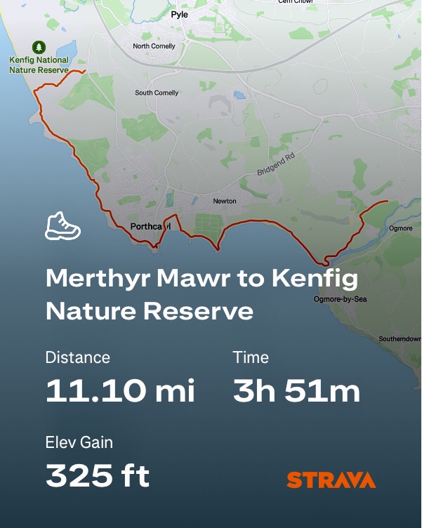
This walk covers the Bridgend section of the Wales Coast Path and offers a range of contrasting scenery including sand dunes, golden beaches, a bustling seaside resort and harbour at Porthcawl, before finishing at the Kenfig Nature Reserve. The distance is 11 miles ‘point to point’.
Parking and Start Point
Merthyr Mawr is a pretty village of colour washed thatched cottages, a place which seems as if it has been lifted from rural Suffolk and transplanted into the Welsh countryside. From the village follow Merthyr Mawr Road to Candleston Castle car park. Parking is pay and display, £5 for all day (at time of writing) payment card only and ANPR cameras are in use.
What3words ///marine.splendid.screamed
On the day of our walk there was a festival being held at Candleston Woods, so we parked in a temporary car park near Ton Farm and walked half a mile to the main car park. A few events are held at Candleston Woods during the summer months, so it’s worth checking dates if you prefer to visit at a quieter time. One such event is the Between The Trees festival click the link to view some wonderful aerial footage which really captures the remarkable natural beauty of the dunes and woodland.
Walk Highlights
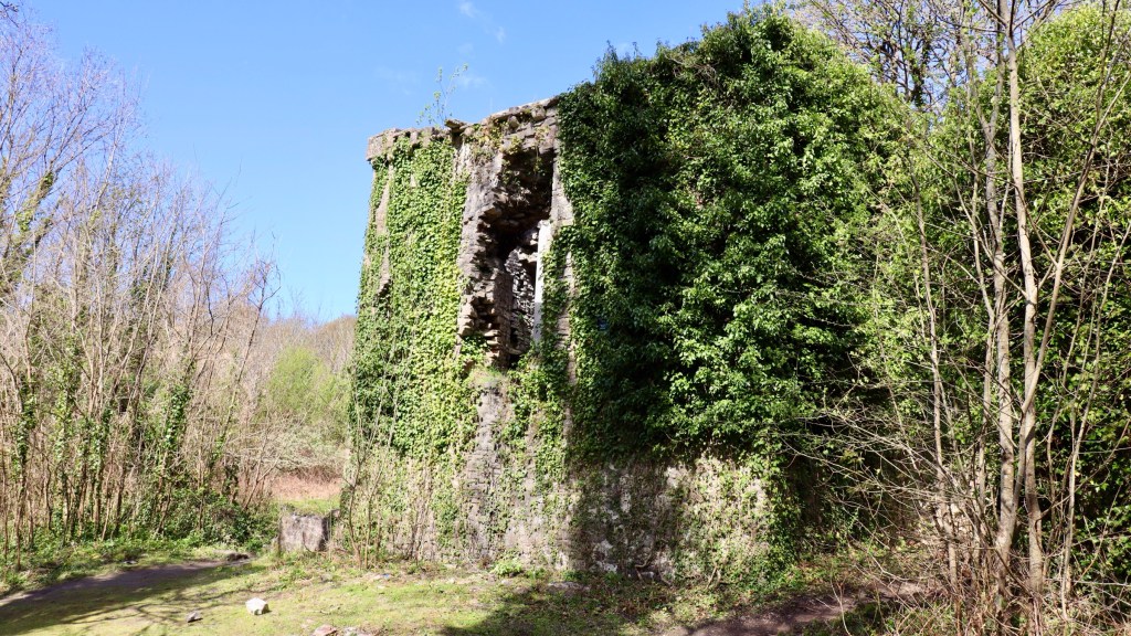
Before heading into the Merthyr Mawr Warren Reserve we first had a look around the ivy covered ruin of Candleston Castle, a 14th century fortified Manor House, tucked away at the edge of the car park.
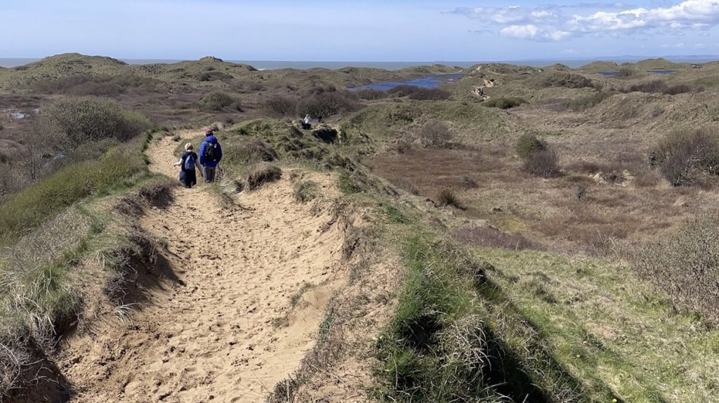
There are a maze of trails through the extensive sand dunes of Merthyr Mawr Warren, including to the famous ‘Big Dipper’. It’s the highest dune in the UK and is a favourite with endurance athletes and sports teams training to build their stamina in the summer months. The vast dunes here also featured in the Lawrence of Arabia movie, as the setting for the Arabian desert scenes.
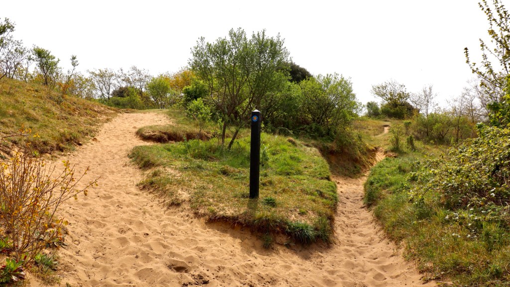
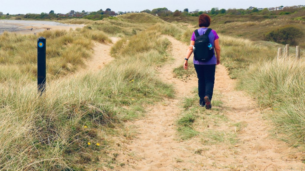
The coast path is way marked from the south east corner of the car park and we are soon walking on soft sandy trails through the dunes. Keep an eye out for marker posts which help to keep you on the right track when trails are leading in different directions.
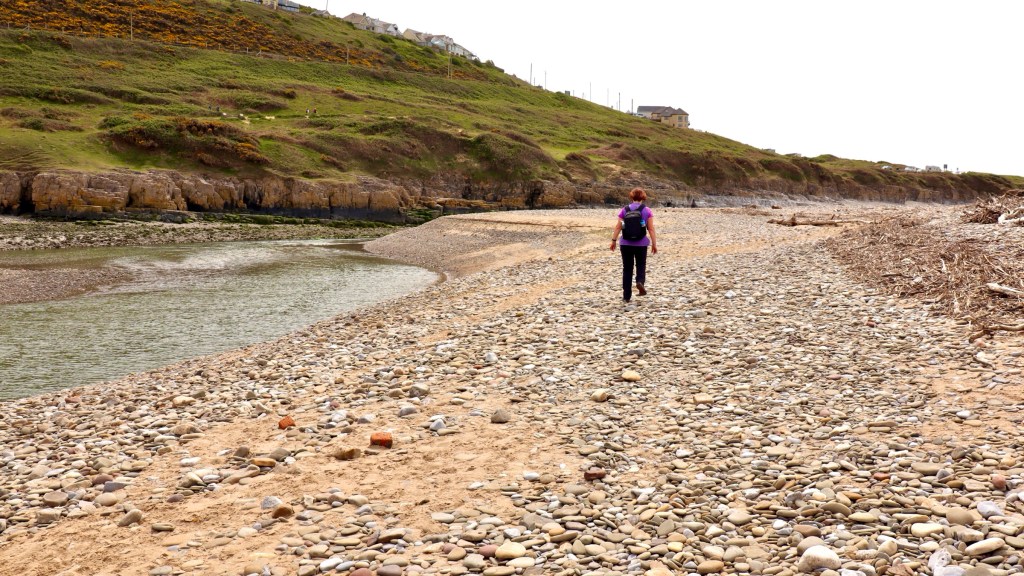
The path emerges on to a pebble bank at the River Ogmore, the landscape here in stark contrast to the grassy hillside on the opposite bank.
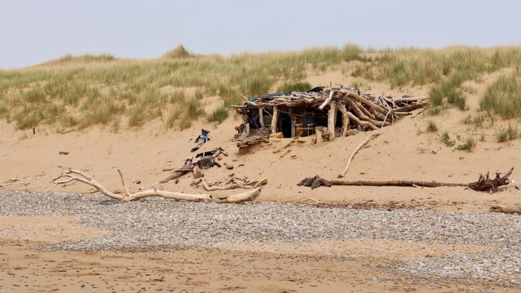
We followed the course of the river down to Merthyr Mawr beach, Traeth yr Afon. It’s a wide sandy beach and nestled in the dunes was a quirky beach shelter, which had obviously taken a lot of effort to construct with driftwood. No one was home as we passed by.
We left the beach to walk along Newton Burrows, a pleasant walk on sandy paths edged with dune grasses and wildflowers.
At the end of Newton Burrows the path goes around the huge holiday caravan park at Trecco Bay. In years gone by it was famous as the destination for the valleys coal mining communities descending en masse in summer during ‘miners fortnight’. It’s still a very popular holiday place, as generations of families have maintained the tradition.
We walked along the back of 2 fine beaches here, first Trecco Bay Beach and then the lovely wide Sandy Bay Beach.

On the day of this walk we became aware of a protest taking place nearby and we learned that a massive redevelopment is planned of this area. It seems locals are against the scale of the development plans and the amusement park known as Coney Beach will be demolished to make way for hundreds of beachfront homes to be built over the next decade. No doubt the place had seen better days as the old funfair looked a sorry sight, its heyday well and truly gone, closing its gates for the last time at the end of September 2025. However the development of nearby natural landscapes is a bitter pill to swallow for many. It will be interesting to see how the coast path will be incorporated in the new plans.
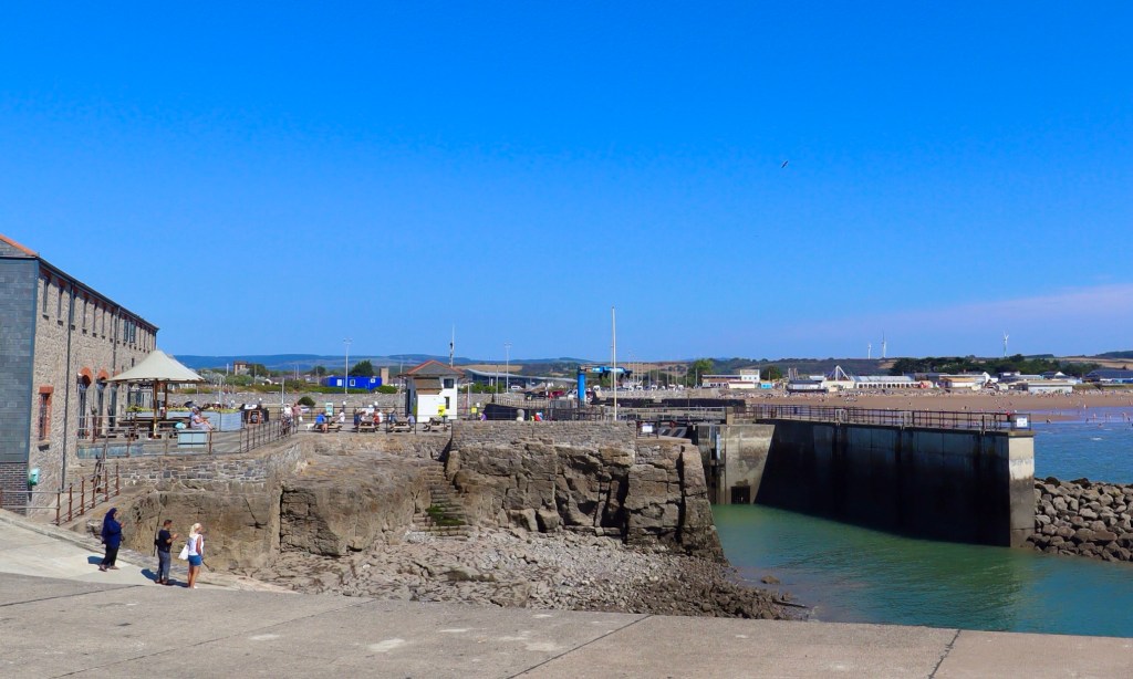
We continued around the promenade to Porthcawl Harbour, which has been improved in recent years and now has some nice cafe bars at the harbourside, a great option for a mid walk refreshments break.
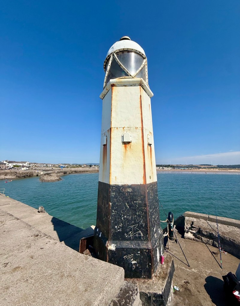
At the end of the harbour breakwater is a cast iron lighthouse, built in 1860. It has gained some fame in recent times for the photo opportunities it provides when stormy weather can see waves dramatically crashing over it. On the day, the weather was fine and calm so we were able to see it close up and enjoy stunning views across the Bristol Channel.
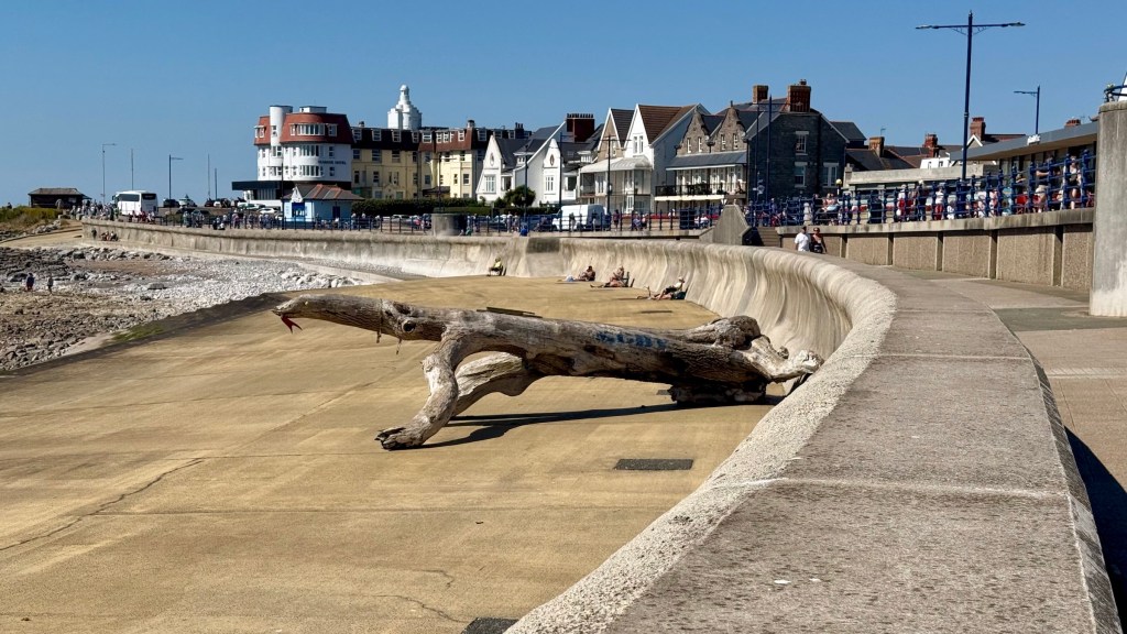
Returning to the coast path we continued along the Esplanade, which is the historic seafront town area of Porthcawl. There have been recent improvements to the streetscape here too and even an unplanned addition of a new attraction, ‘Lizzy the Lizard’.
A huge piece of driftwood washed up after storms in 2024 and soon became a local landmark due to its resemblance to a sea creature. It was soon decorated with eyes and a tongue and people queued to have photos with it. With some councils known to spend vast sums on public artworks and sculptures, Porthcawl got lucky when Lizzy washed up on it’s shores for free!
The path continues to the end of West Drive, where the lovely open space of Locks Common begins. At this point the Wales Coast Path continues roadside along Mallard Way towards Rest Bay, however views of the coast are limited.
A much nicer walk is to take a leftwards turn onto Locks Common, taking one of the trails offers the opportunity to be closer to nature with some fantastic views across the rugged coastline.
At the far end of Locks Common there are more fine views across the ever popular and magnificent golden sands of Rest Bay.
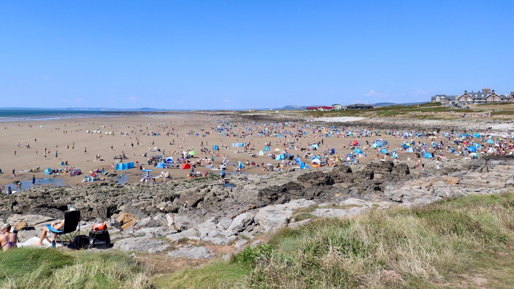
Rest Bay has been a favourite surf spot for many years and now has a modern water sports centre, cafe and toilet facilities.
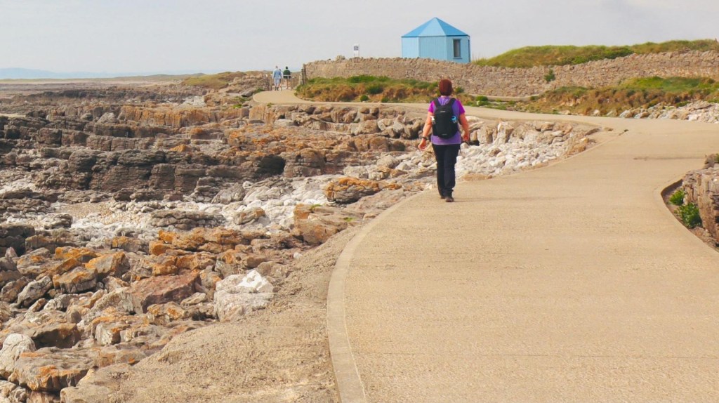
Passing Rest Bay the coast path continues on a wide concrete surface hugging the low rock terraces and following the boundary of the Royal Porthcawl Golf Club. Further along a boardwalk has made a section of the coast path more accessible.
Approaching Sker Point the landscape becomes more remote and windswept. Inland is the grand yellow painted Sker House, considered to be one of Wales finest historic houses and originally established as a monastic grange 900 years ago.
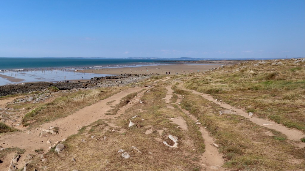
After Sker Point the path heads into the dunes of Kenfig Nature Reserve and we turned here to walk inland for the final mile. It was somewhat hard going on soft sand paths with some turn backs to find the right path and swampy areas to navigate before we reached the visitor centre car park.
For the essential end of walk refreshments there are a couple of options:
The Hyde Out Coffee bar situated in the Nature Reserve car park for light refreshments or an excellent selection of Ales and hearty fare can be found just a half mile up the road at an historic old pub, The Prince of Wales Inn, Kenfig, CF33 4PR.
Until we lace up our boots again, Happy Wandering.
Route Stats
To return to our start point, as public transport options are limited between the 2 locations, we opted to use a second car parked at the end of the walk at Kenfig Nature Reserve.
To return to the start point by bus, as there are no direct services, 2 journeys would be necessary: No. 63 from South Cornelly (1.4 miles walk from the Kenfig Reserve) to Bridgend; then No. 303 from Bridgend to Ogmore by Sea, bus stop at Ogmore Water Works (1.25 miles walk to Candleston Car Park). Journey Planner and timetables.

I remember that beach shelter. What a contrast. Rest Bay beach was deserted when I hiked past on a cold day in January. The Kenfig Burrows were an unexpected highlight, all frosted over, steam rising on the horizon from the Tata steelworks. Beauty where you least expect it.
LikeLiked by 1 person
Cheers Tony, I remember you thought you’d stumbled on a crime scene at Merthyr Mawr but it turned out there was a crew filming on location! You’re right about the contrast, you captured some wonderful atmospheric scenes along this section.
LikeLiked by 1 person
beautiful scenic photos and well narrated information, enjoyed reading about your walk
LikeLiked by 1 person
Thank you 🙏
LikeLike
This stretch of the coast path is next on my list to walk, as I’ve walked parts of it, but not the trail in its entirety. It’s beautiful. I hadn’t realised Coney Island recently closed, it’ll be odd to go to Porthcawl and it not be there.
LikeLiked by 1 person
Hi, I’m sure you’ll enjoy this stretch as there’s so much variety along the way and the landscape is so different to the rest of the Glamorgan Heritage Coast. Yes with the funfair area being redeveloped it’ll be a very different feel to the place in future.
LikeLiked by 1 person
tidal variance looks intense
LikeLiked by 1 person
Hi Cindy, it is indeed. This coast has the second highest tidal range in the world. The tidal range can reach up to 15 metres.
The only place with a higher tidal range is the Bay of Fundy in Canada!
LikeLike
Rich – what an epic walk. As well as the usual glorious photos and descriptions of the walk, the background information and history that accompanies these make this a very informative and enjoyable read. Unusual highlights for me were the chair in the beach shelter at Merthyr Mawr beach and “Lizzie ” at Porthcawl. A walk of 11+ miles (nearly half a marathon …) for nearly 4 hours certainly takes some doing.
Cato.
LikeLiked by 1 person
Thanks Cato, much appreciated
LikeLike