In the maritime heyday of tall sailing ships, the natural deep waterway of Milford Haven was renowned for its scenic beauty and famously described by Lord Nelson as the ‘greatest natural harbour in the world’.
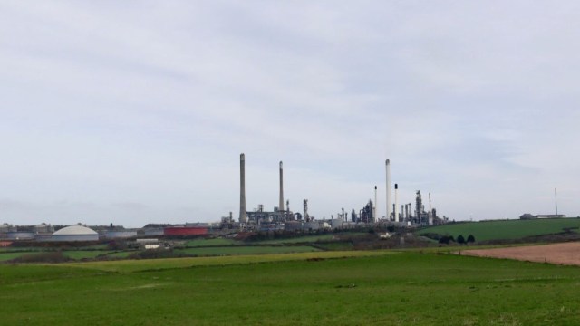
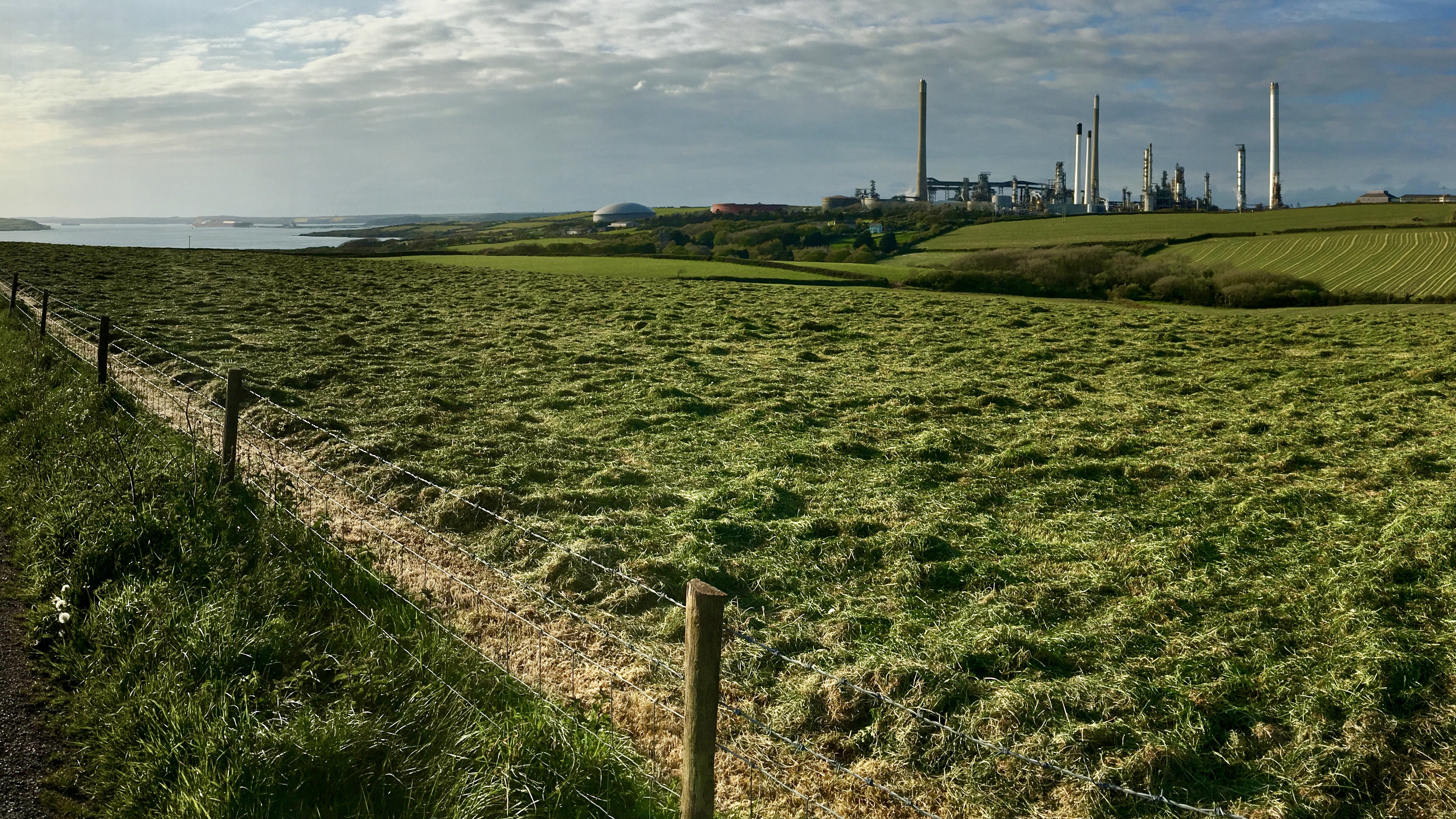
However, this superb accessibility for ships meant during the 20th century the age of the ‘super tanker’ brought a great deal of industrialisation, so oil refineries, gas terminals and power stations now dominate parts of the Haven.
Since starting out on the Pembrokeshire Coast Path in Amroth, experiencing the magnificent scenery along every section of the South Pembrokeshire coastline had become the norm. Unfortunately industry has scarred parts of the natural environment along the Haven Waterway, some walking guidebooks even suggest to those not concerned with completing the whole coast path route, to consider skipping this area.
But for us it’s all part of completing the trail and experiencing both the natural and built environment so we’ll be walking around the 30 plus miles in stages.
This first stage is a circular walk, starting from East Angle Bay and following the coast path as far as Pwllcrochan Church, then returning via countryside lanes.
From Angle Bay the path joins an access road and passes by a huge oil refinery facility which dominates the landscape and dwarfs some old farmhouses which lie in its shadow.
The path trails around the edge of fields, as ahead the substantial walls of a Palmerston era military fort come into view. Popton Fort was constructed between 1859 – 1864 and holds an imposing position overlooking the estuary.

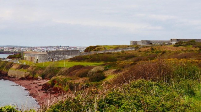
Approach to Popton Fort
Popton Fort is now owned by an oil refinery company and the site is off limits with visible high security. The coast path leads inland around the site boundary then across fields.
It’s a surprisingly pleasant countryside walk through an ancient woodland with some old ivy covered ruins and masses of bluebells, wildflowers and butterflies above a small inlet known as Bulwell Bay. For a time it was possible to forget there was any heavy industry nearby.
The path follows the lower boundary fence of the refinery near the waterway and you pass below the huge pipelines connecting extensive jetties and tankers.

Walking uphill and across farm fields provides views across the Haven shipping lanes before the path heads inland through countryside eventually reaching the picturesque St. Mary’s Church at Pwllcrochan.
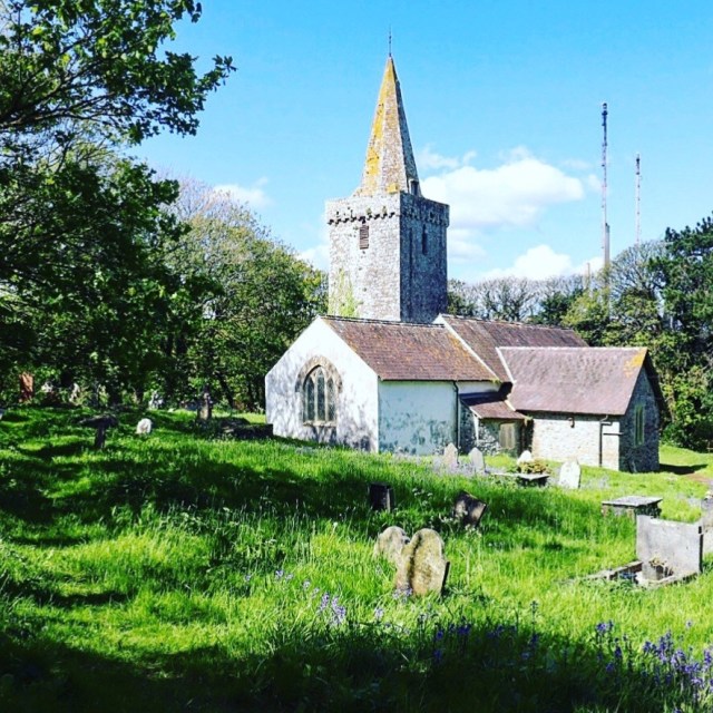
The beautiful church in this tranquil setting dates from 1342 and was once at the heart of a thriving rural community. The village perhaps understandably has long gone, a few ruins such as an old school house all that remain as reminders of a community around the church.
The church is now managed as an education centre by multinational oil company. The surrounding land is a nature conservation area with boardwalks across marshland , so a small but welcome, haven for wildlife.
The return walk from here followed the road up to Wallaston Cross then along quiet country lanes next to some wonderful farm land being prepared for Pembrokeshire’s famed new potatoes.
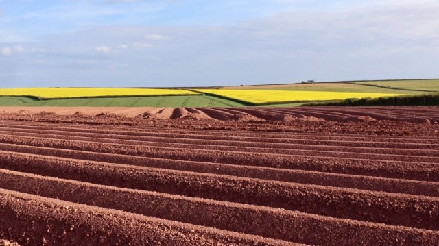
Wonderful colours of a farmland landscape
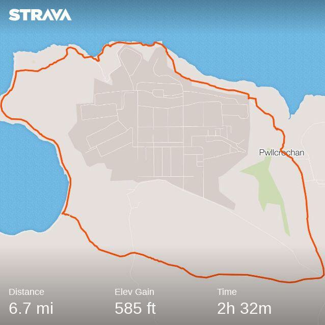
Route Stats
A circular 6.7 mile short walk of contrasts and points of interest along the way.

ah! thanks for sharing, brings back my own memories of walking the path of hostels, pubs and the beauteous Welsh countryside.
LikeLiked by 1 person
Lovely comment thanks!
LikeLike
You’re welcome :}
LikeLiked by 1 person
Still interesting Rich as it throws a bit of light on the reality of how industry has a part to play in ongoing lives
Cato
LikeLiked by 1 person