This walk takes us to the westernmost point in South Pembrokeshire, as we headed westwards on the coastal path around Marloes Peninsula.
Our start point was in Dale village, at the Beach Car Park, near the Boathouse Cafe. But it was only the pay and display machine being fed as we parted with a handful of silver for a ticket. A couple of fellow walkers were at the machine, scrabbling to make up the required amount for parking, so we happily offered our loose change so they could get a ticket.
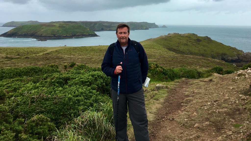
So a little lighter in pocket we set off, along a lane passing Dale Castle then across a field, joining the coast path above West Dale beach, the point we had reached previously on Walk 17.
It was an overcast day, the hue of the sea matched the cloudy grey sky but at least it was dry and cool. Heading uphill we looked back across to Great Castle Head, site of an Iron Age promontory fort on the imposing headland opposite and the steps on the hillside we had descended on our previous walk.
From this vantage point the overcast skies brought out the darker colours of the surrounding countryside, giving the appearance of a lush emerald green carpet hugging the rugged coastline.

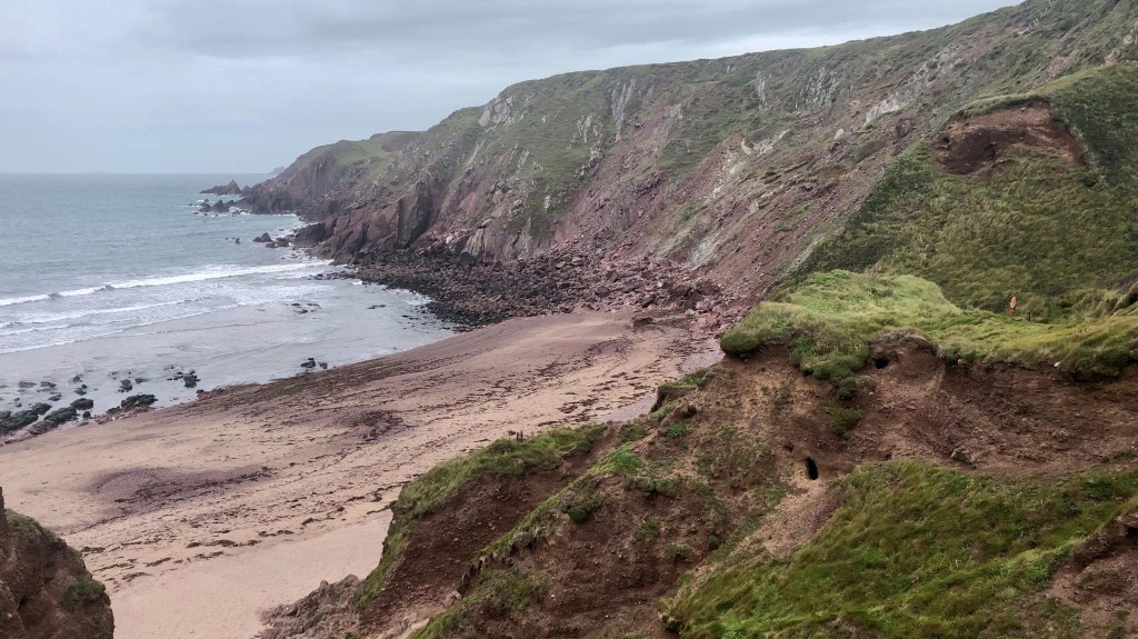
Continuing towards Hooper’s Point, on our right is a plateau of land with the remains of concrete runways of an old World War 2 airfield, while to our left the cliffs slope sharply to the sea, which swells around jagged rocks.
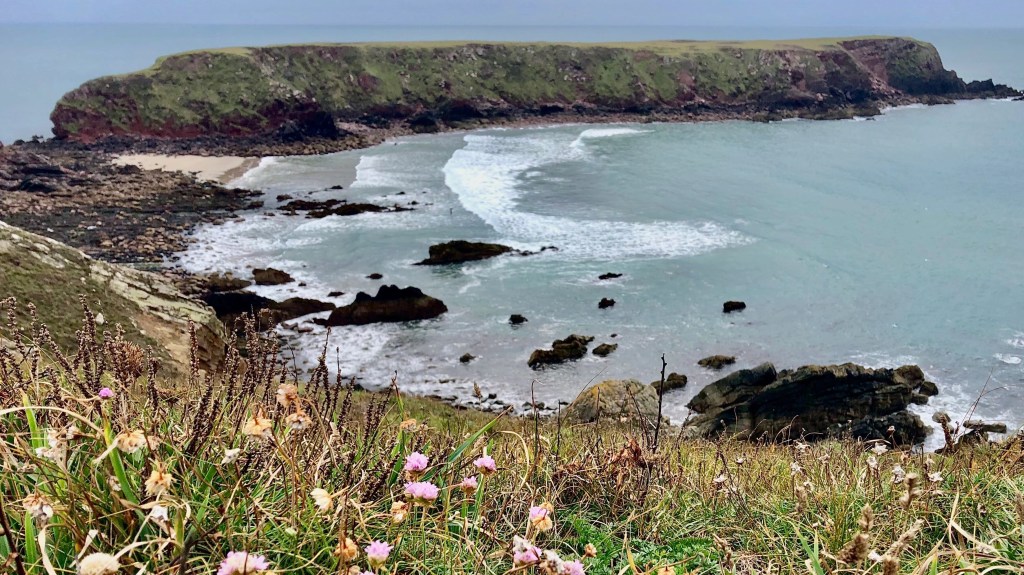
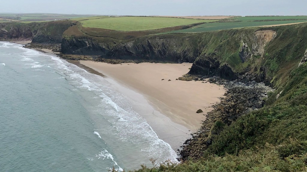
After rounding Hooper’s Point, a magnificent view opens up across Marloes beach. This entire coastline of Marloes beach, Gateholm Island and most of the countryside on the peninsula is owned by the National Trust, who describe this coastline as a “hidden gem nestled on the very western edge of Pembrokeshire”.
It really is an idyllic, peaceful stretch of coast. But if you should need a break there’s access to Trust facilities at Marloes Mere and a highly rated cafe at Runwayskiln.
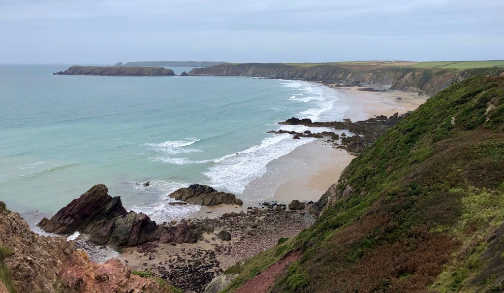
The path follows above the clifftops maintaining the great views across the wide sands, and the restored heathland (see link for video on project) on the landward side.
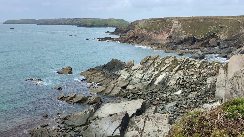
The path descends into a valley with access onto the beach, for those who don’t mind some rock-hopping across a wide band of boulders. This part of the beach has huge dark jagged outcrops, known as the ‘Raggle Rocks’.
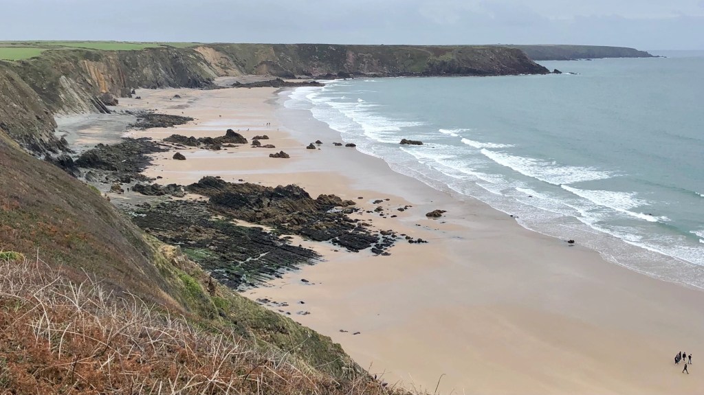
The path climbs above the western side of the bay, with more magnificent views back across the grand sweep of Marloes Sands. It looks a great setting for an invigorating beach stroll, so we’ll be sure to return to explore more at a future date.
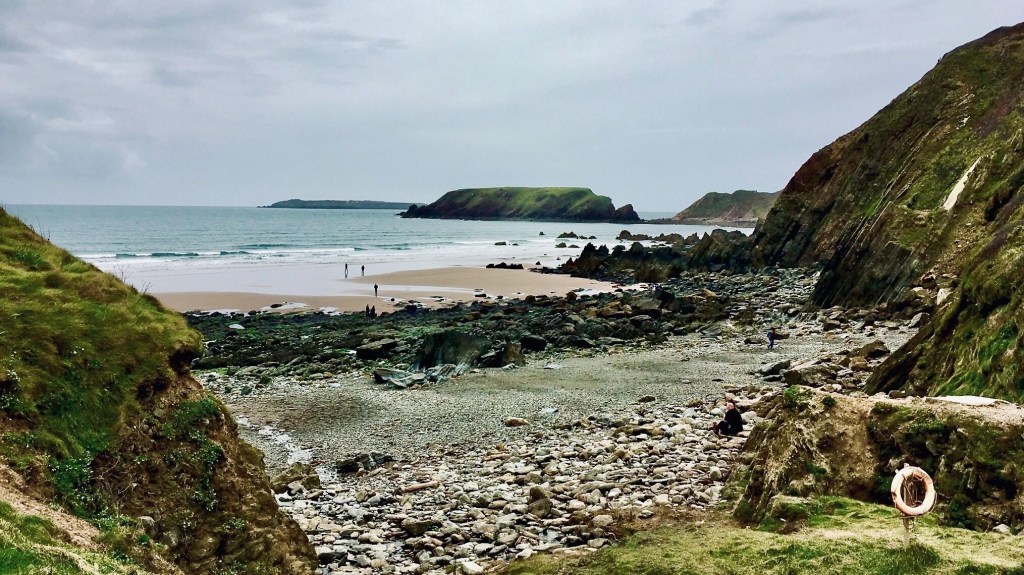
Further along and directly ahead is Gateholm, a tidal island and site of an Iron Age settlement. Channel 4’s Time Team paid a visit in 2012, a fascinating episode as they explored its history. Click the link to view this interesting episode here.

On the western side of Gateholm is Albion Sands, a small bay only accessible at low tide. The beach takes its name from the paddle steamer ‘Albion’ which was wrecked on the rocks here in 1837 whilst sailing from Dublin to Bristol. At low tide some parts of the wreck can be seen. Apparently the Albion was carrying a large amount of whiskey and porter beer, which were salvaged by locals with other goods and sold off from the beach. No doubt, the locals were likely to have been very merry well into 1838.
Continuing along this section, there’s some dramatic cliffs and extremely weathered rocks, which looked particularly grim and treacherous on a grey overcast day.

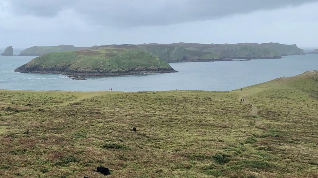
As we head towards the most westward point of the peninsula, the offshore islands of Skomer and Middleholm come into view. We pass the darkly named ‘Deadman’s Bay’ which perhaps points to the treacherous nature of this coastline to mariners, in times past.
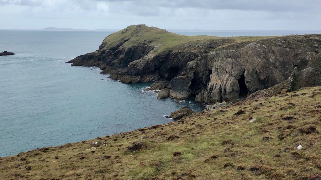
We reach the ‘Deer Park’ at Wooltack Point, although this area isn’t part of the ‘official’ coast path. The park has never had any deer, but in the 19th century the landowners constructed a stone boundary wall with the intention of establishing a deer park.
There are paths across Wooltack Point, and wonderful views of the coastal islands to the west and St. Brides Bay to the north.
The detour around the Deer Park was both worthwhile and memorable as when walking the tracks around the clifftops, from the sheltered coves below the unmistakable sound of grey seal pups could be heard. The pups distinctive, eerie wailing calls were amplified by the high cliffs and there was an occasional sighting of a parent seal in the waters nearby.
An experience that brought to mind the quote by John Muir “in every walk in nature one receives far more than he seeks”.
Nearby is Martin’s Haven, which has washroom facilities and a slipway for boat trips to Skomer Island, famous for it’s puffins and seabirds.
Continuing our walk along the north side of Marloes Peninsula, the scenery may be less dramatic with green topped cliffs and gently undulating terrain, but still pleasant views ahead to Musselwick Sands.
We reached Musselwick Sands where the path descends into a small valley with access to the beach and a path leading back inland to Marloes. We left the coast path at this point, taking the track which heads across fields then joins a lane into Marloes Village. We ended our walk in the village at The Clock House restaurant, where we met our family who joined us for some customary end of walk refreshments. They gave us a lift back to Dale’s Beach car park, where we found that the walkers we’d met at the pay machine earlier had kindly left a pound coin on the roof of our car.
So a wonderful walk covering a magnificent part of the coastline and we ended the day with a small profit too!
Route recap
> Walk distance ~ 9 miles ‘point to point’
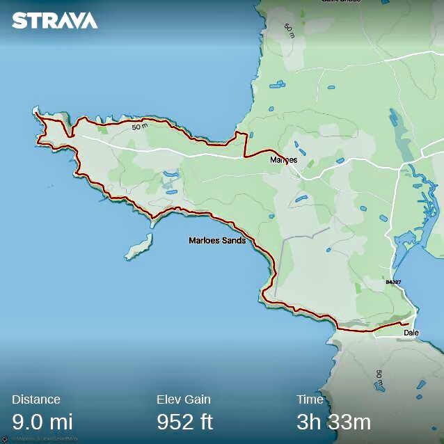
> Time ~ allow 4 hours with a break and taking photos
> Recommended rest stops:

Marvelous landscape photos and matching descriptions as usual for this really long second walk of the new re-start. The Time Team link proved more than interesting , adding to Rich`s descriptions of Gateholm. How on earth did people live on the island all that time ago ?
Look forward to the next walk.
Cato
LikeLiked by 1 person
Thank you very much Cato, your interest and comments are a great boost as we get back out on the trail!
LikeLike
Another outstanding walk with amazing photos and description.
A great experience without having to leave our armchairs. Looking forward to the next part of your journey.
LikeLiked by 1 person
Thank you Petrosa, great to hear that you enjoyed reading this latest post and following us on the trail.
LikeLike
I’m now following your blog and enjoying trailing along with you along your lovely coastline. I know only a few places in Wales, mostly in the Swansea/Mumbles are where my brother-in-law lived and Newport/Caerleon where I spent a week and toured around. Your images are really lovely and have re-kindled my desire to visit Wales once more although walking is not easy for me now. I’m lucky to live in an area of easily accessible walks but I can’t do long distances now. I look forward to reading future posts. I dipped into what you have posted already and enjoyed them.
LikeLiked by 1 person
Thank you Mari, really pleased you enjoyed reading the blog. Your lovely comment and interest will put a spring in our step for our next walks.
LikeLike
I enjoyed your photos of this area, as it brought back memories of a trip I once made there, a long time ago. Some of your images looked so familiar, perhaps very like some of mine that I took at the time. But mine were pre-digital – little 6 x 4 inch prints I think. Isn’t it wonderful to have such advanced technology now!
LikeLiked by 1 person
Thank you Helene, lovely to hear this post brought back pleasant memories. You’re right too about the advances with digital cameras, no more waiting a week or more to get your prints! Best Wishes, Rich
LikeLike
So excellent photos with beautiful descriptions 🎉💕well shared. The place is looking beautiful thank you 🎉😊💕
LikeLiked by 1 person
Thank you Priti for your lovely comment
LikeLike
Thanks for stopping by my humble blog…I like your topics here and thought you might be interested in my trekking books…Trippin’ Through My Sixties: When adventure calls, the trails of Europe answer (just published) and Camino Sunrise. I look forward to your posts!
LikeLiked by 1 person
Thanks Reg, will look up your books and look forward to following your trekking adventures!
LikeLiked by 1 person