This walk starts at ‘The Gann’, and continues on an 8 mile circular route around the Dale Peninsula.
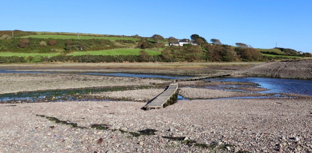
We had previously reached The Gann on Walk 16 , the tidal estuary which can only be crossed by a boardwalk on the low tide for about 4 hours each day.
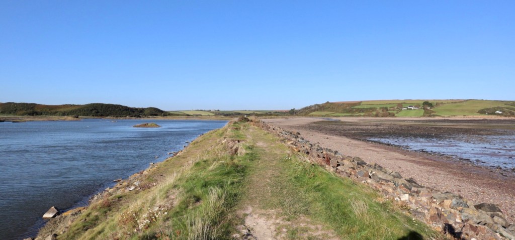
The boardwalk leads onto a shingle beach and raised embankment, known as ‘The Pickelridge’ which borders large salt marsh pools.The tidal estuary and pools are a haven for wildlife, particularly wading birds and is one of Pembrokeshire’s best birdwatching sites.
From here the coast path follows a country lane into Dale village, where the road along the seafront overlooks the wide bay which is popular for sailing.
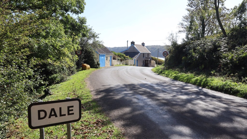
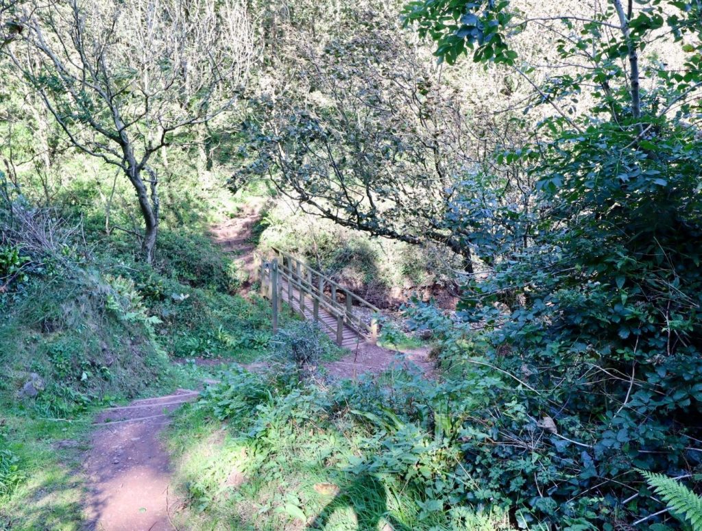
We headed out of the village, passed the local pub The Griffin Inn and followed a narrow country lane towards Dale Point. There’s an old 19th century fort, now an education centre and the coast path turns inland near the entrance, tracking along the edge of crop fields before meandering through a lovely shaded valley woodland near Castlebeach Bay.
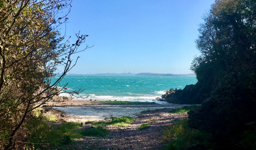
The path drops down to the shoreline where an opening in the trees reveals a small secluded beach here, with views directly across to the Power station on the opposite side of the Haven waterway.
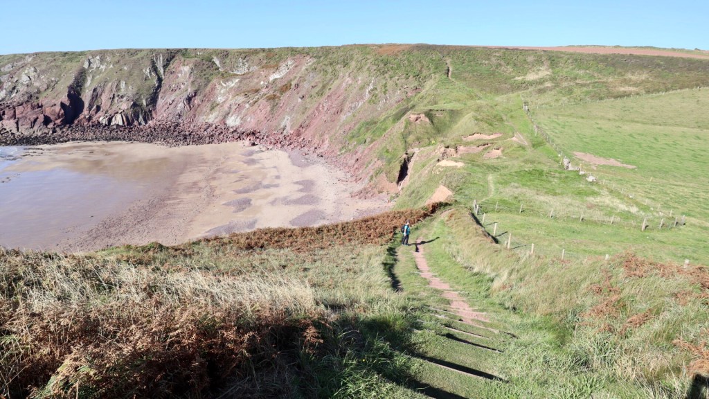
The path climbs back to high ground above the cliffs with fine views across this eastern side of the Peninsula, of gently rolling fields and lush woodland, above exposed rocky cliffs.
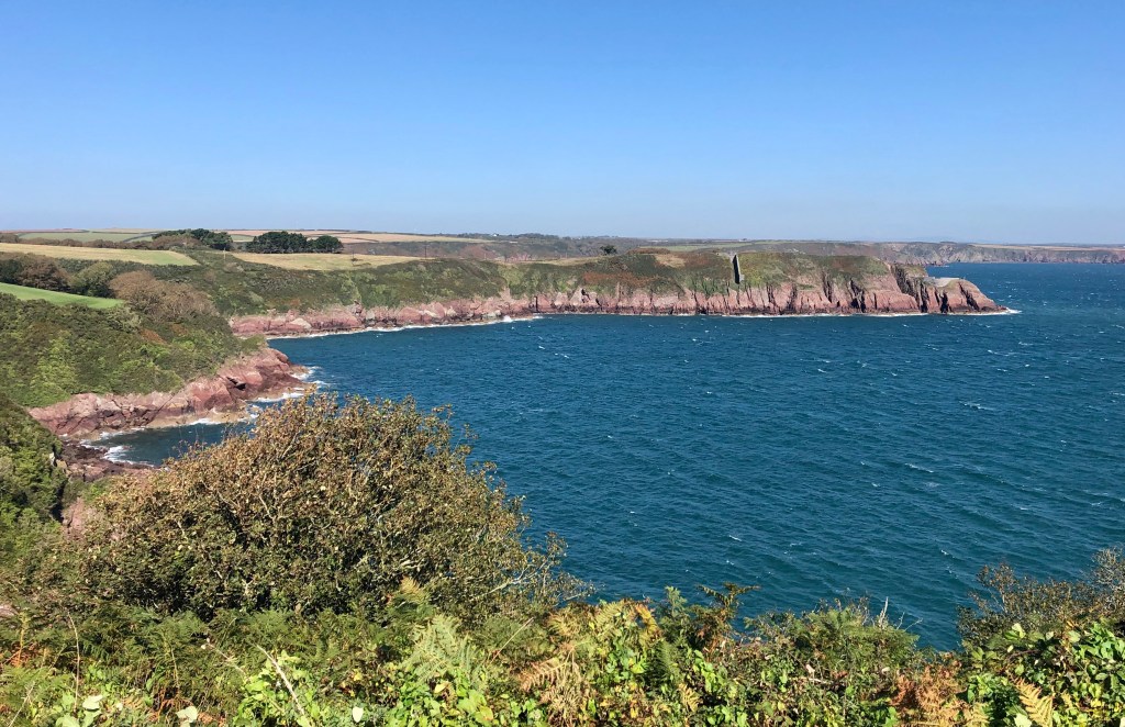
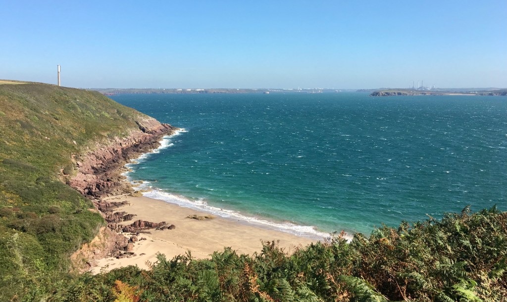
There are views across the waterway to the Angle Peninsula while there’s a lovely view of the secluded, picturesque beach at Watwick Bay.
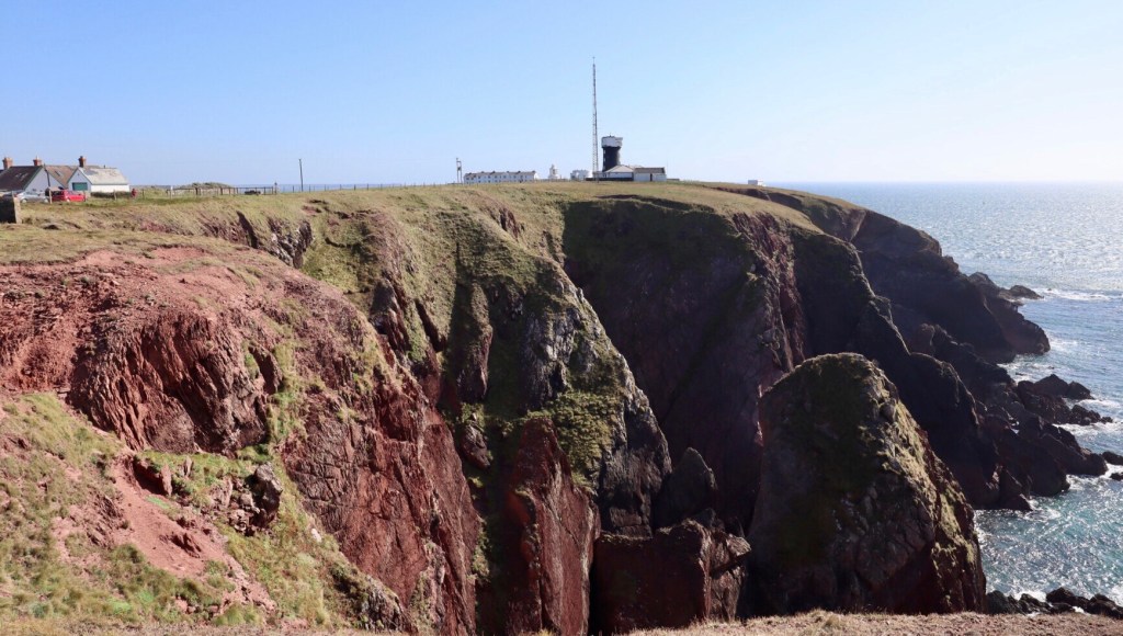
A feature here are communication beacons for shipping entering the Milford Haven Waterway. At West Blockhouse Point, 3 huge structures tower above the path, blots on the natural landscape perhaps, but providing an essential service for safe passage of the huge tankers navigating the waterway.

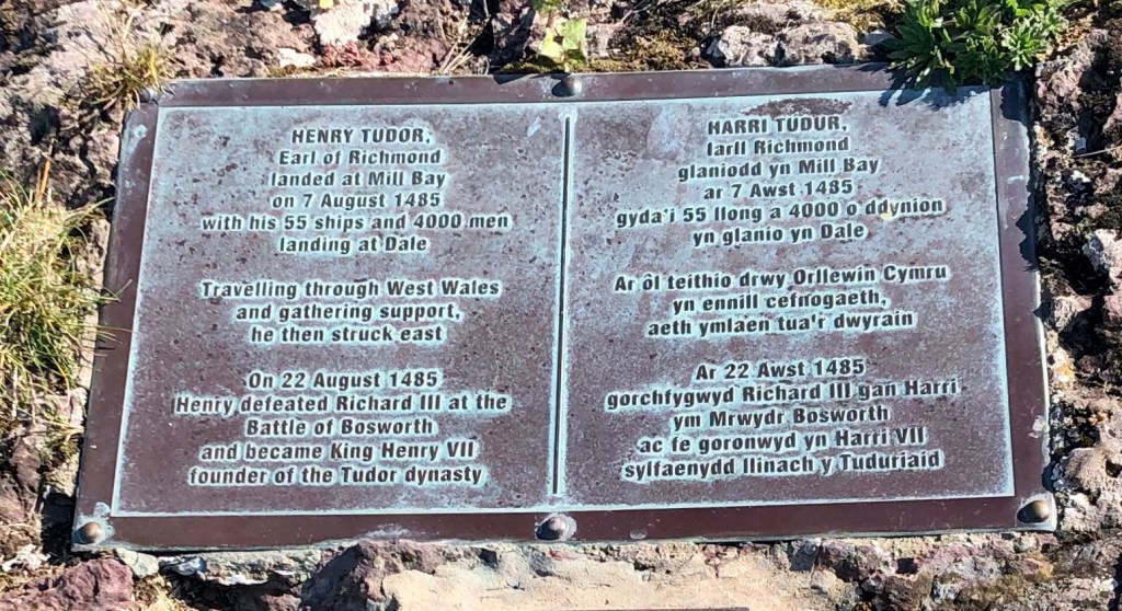
Further along the path passes above Mill Bay, a place of some historical significance. It was here in 1485 that Henry Tudor landed on his return from 14 years exile in France. For a moment you can let your imagination picture a scene of his fleet of 55 ships and thousands of soldiers coming ashore to begin their long march to destiny and Henry’s victory over Richard III at the Battle of Bosworth.
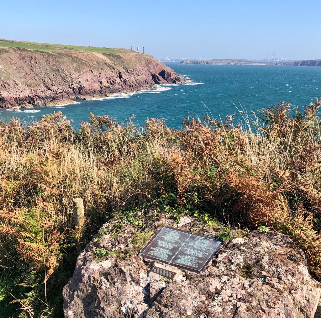
A plaque on the coast path marks this location and momentous events.
The path then crosses fields to reach St. Ann’s Head, a lighthouse sited at the tip of the peninsula. This spot is recorded as having the highest annual amount of sunshine in Wales and the day of this walk was no exception.
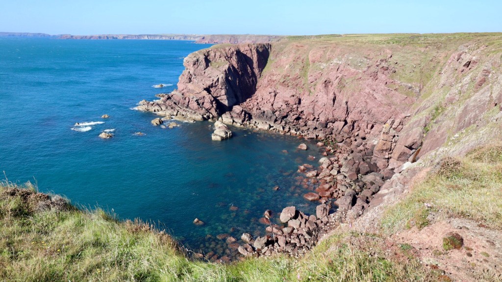
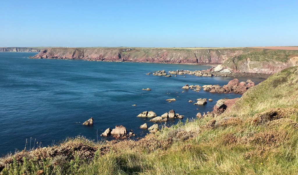
On this western side of the peninsula there’s a noticeable change in the coastal landscape as the exposed aspect see dramatic cliffs and grassy headlands. This makes for a pleasant walk along this section as the path rounds above deeply eroded bays if rich coloured red sandstone rocks contrasting with a vibrant blue hue of the sea to provide spectacular scenery.
Highlights along this section are a deeply indented bay with jagged and sheer cliffs intriguingly named as ‘Vomit Point’!
There are fine views from the grassy headland westwards to Skokholm Island, especially on a day like this when the sun is shining and there’s a refreshing sea breeze, for a healthy top-up dose of ‘Vitamin Sea’.
On the approach towards Westdale Bay, there’s a view inland across the valley of rolling green fields, Dale Castle and in the distance, Dale bay.

We soon reached the headland, ‘Great Castle Head’ the site of an Iron Age promontory fort overlooking Westdale Bay, a lovely scenic beach flanked by high sloping cliffs.
At Westdale Bay we took the option of the inland path which passes Dale Castle and leads into the village.

We ended our walk enjoying a refreshing pint at The Griffin a fine old pub with lots of character and a snug bar. We were lucky to get seats near a window with a fine view overlooking the bay.
Route Recap

> Walk distance ~ 8.5 miles including the crossing at The Gann
> Time ~ Allow 3 and a half hours to include rest breaks and viewpoints
> Recommended post walk refreshments @ The Griffin, Dale

Wow what an amazing walk such beautiful photos of the scenery and bays, so well written.
Looking forward to the next part of your journey.
LikeLiked by 1 person
Thanks for such a lovely comment, puts a spring in the step for our next walk. Rich
LikeLike
Well at last a return to some sort of normality with Walk 17.
Lovely to read as usual.
The pictures are amazing – helped no doubt by the sunny weather on the day.
Words and pictures dovetail in really well to one another.
Interesting names to all the bays and places…Who came up with Vomit Point ?
Is there a pub nearby ? This walk series is very popular. Well deserved.
Cato.
LikeLiked by 1 person
Thanks Cato, certainly agree a long awaited return to some normality. You’re right about the weather conditions, it does make such a difference to how the camera captures the scenery. Vomit Point, yes it makes you wonder about the origins behind that name. Thanks again. Rich
LikeLike
Hello Rich, good to see you’re back on your feet again. Enjoyed the read!
LikeLiked by 1 person
Thanks Niles, it’s good to see the Status Quo return!
LikeLike
Looks absolutely amazing, such stunning scenery
LikeLiked by 1 person
It is a wonderful part of the coast. Thanks for interest! Rich
LikeLiked by 1 person
I love reading about other walkers/hikers walking adventures…
LikeLiked by 1 person
Wow! Wonderful photos of coast ! Beautifully written thanks
LikeLiked by 1 person
Thank you Priti, such a lovely comment and so pleased that you enjoyed reading about the beautiful Wales coast
LikeLike